James Branch (Broad Creek tributary) facts for kids
Quick facts for kids James Branch |
|
|---|---|

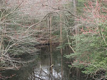
James Branch looking downstream from DE Route 24 crossing
|
|
|
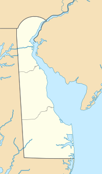
Location of James Branch mouth
|
|
| Other name(s) | Tributary to Broad Creek |
| Country | United States |
| State | Delaware Maryland |
| Counties | Sussex Wicomico |
| Physical characteristics | |
| Main source | divide between James Branch and Wicomico River about 3 miles east of Delmar, Delaware 55 ft (17 m) 38°27′36″N 075°30′14″W / 38.46000°N 75.50389°W |
| River mouth | Records Pond (Broad Creek) Laurel, Delaware 3 ft (0.91 m) 38°33′21″N 075°32′46″W / 38.55583°N 75.54611°W |
| Length | 10.97 mi (17.65 km) |
| Basin features | |
| Progression | west |
| River system | Nanticoke River |
| Basin size | 70.1 square miles (182 km2) |
| Tributaries |
|
| Waterbodies | Ellis Pond Trussum Pond |
James Branch is a cool stream, about 11 miles (17.65 km) long, that flows into Records Pond. Records Pond is part of a larger stream called Broad Creek. James Branch starts in northern Wicomico County, Maryland and flows north into Sussex County, Delaware. Delaware even calls it a special paddling trail, which means it's a great place for kayaking or canoeing!
Contents
Where Does James Branch Flow?
James Branch begins its journey in Maryland, about 3 miles (4.8 km) east of a town called Delmar, Delaware. At its start, the land is about 55 feet (17 meters) above sea level. This is where the water divides between James Branch and the Wicomico River.
Its Path to Records Pond
As James Branch flows, it travels through two different states. It starts in Wicomico County, Maryland, and then crosses into Sussex County, Delaware. The stream eventually ends its journey in Laurel, Delaware, where it joins Records Pond. At this point, the water is only about 3 feet (0.9 meters) above sea level.
Part of a Bigger System
James Branch is a tributary, which means it's a smaller stream that flows into a larger body of water. In this case, it flows into Records Pond, which then connects to Broad Creek. Broad Creek is a tributary of the Nanticoke River. So, James Branch is part of a much larger river system that eventually leads to the Chesapeake Bay. The area of land that drains into James Branch is about 70.1 square miles (182 square kilometers).
Tributaries and Ponds
Many smaller streams and ditches flow into James Branch, adding to its water. These are called tributaries.
Streams Joining James Branch
- Old Forge Branch (joins from the left side)
- Figgs Ditch (joins from the right side)
- Morris Branch (joins from the right side)
- Wards Branch (joins from the right side)
- Hitch Pond Branch (joins from the right side)
- Gordon Branch (joins from the right side)
Ponds Along the Way
Two notable ponds are connected to James Branch:
- Ellis Pond
- Trussum Pond
These ponds are important parts of the local environment and provide habitats for many plants and animals.
Fun Activities on James Branch
Because James Branch is listed as a state-protected paddling trail by Delaware, it's a great spot for outdoor adventures.
Paddling and Exploring
If you enjoy being on the water, James Branch offers opportunities for:
- Kayaking: Gliding through the calm waters in a kayak.
- Canoeing: Exploring the stream with friends or family in a canoe.
These activities allow you to see the natural beauty of the area up close. You might even spot some local wildlife!
 | Aaron Henry |
 | T. R. M. Howard |
 | Jesse Jackson |


