James Robertson (surveyor) facts for kids
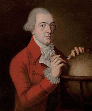
James Robertson (1753–1829) was a Scottish surveyor and map-maker from the 1700s. He became a Fellow of the Royal Society of London, which is a very old and respected group for scientists. He is best known for creating very accurate maps of Jamaica.
Early Life and Education
James Robertson was born on the island of Yell in the Shetland Islands, which are north of mainland Scotland. He was the youngest of ten children. His father, John Robertson, was a merchant, meaning he bought and sold goods and was quite well-off.
When James was young, his family moved to Aberdeen. He went to Aberdeen Grammar School and later studied at Marischal College in Aberdeen. He finished his studies in 1778, earning a master's degree.
Mapping Jamaica
Around 1778 or 1779, James Robertson moved to Jamaica. There, he started a business leasing cattle to people who owned large farms called plantations. He began making maps by 1791.
In 1796, he convinced the House of Assembly (which was like the government of Jamaica at the time) to hire him. They asked him to spend three years mapping the entire island. He finished his first set of maps, which showed one inch on the map for every mile in real life, by November 1799.
He was then asked to create even more detailed maps, which he completed in 1801. For all this work, he was paid a huge amount of money, about £10,450. This was a massive fortune back then!
After finishing the maps, James traveled to London to get them printed and sold. His maps were officially published in 1804. While in London, he lived in the Pall Mall area.
Later Work and Challenges
In December 1810, James Robertson was chosen to be a Fellow of the Royal Society of London. This was a great honor, showing that his work was highly respected by leading scientists.
He tried to get the British Navy to hire him to map the Orkney Islands and Shetland, but he wasn't successful. He also tried to get landowners to hire him to map Northumberland in England, but that didn't work out either.
However, he did get a job from local landowners to map Aberdeenshire in Scotland. He started this project in 1810, but it wasn't considered "finished" until 1822. The people who hired him were not happy with the final maps because they had many missing details.
James Robertson went to court in Edinburgh to try and get the money he was owed for the Aberdeenshire maps. But the problem was still not solved when he passed away in Edinburgh on January 15, 1829.
A Lasting Legacy
Even though his later work had problems, James Robertson's maps of Jamaica were incredibly good. In the 1980s, these old maps were compared to modern maps made with new technology. It turned out that Robertson's Jamaican maps were about 98% accurate! This shows how skilled he was as a map-maker.
 | Shirley Ann Jackson |
 | Garett Morgan |
 | J. Ernest Wilkins Jr. |
 | Elijah McCoy |


