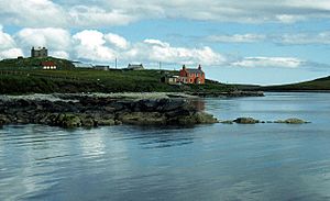
Yell, Shetland facts for kids
| Norse name | Jala |
|---|---|
| Meaning of name | Possibly of Pictish origin or from Old Norse for 'barren' |
| OS grid reference | HU492935 |
| Coordinates | 60°37′N 1°06′W / 60.62°N 1.1°W |
| Physical geography | |
| Island group | Shetland |
| Area | 21,211 ha (81.9 sq mi) |
| Area rank | 11 |
| Highest elevation | Hill of Arisdale 210 m (689 ft) |
| Administration | |
| Sovereign state | United Kingdom |
| Country | Scotland |
| Council area | Shetland Islands |
| Demographics | |
| Population | 966 |
| Population density | 4.5 people/km2 |
| Largest settlement | Mid Yell |
Yell is a large island in the Shetland group, located in Scotland. In 2011, about 966 people lived there. It is the second largest island in Shetland, after the Mainland. Yell is also the third most populated island in the Shetland archipelago.
The island's ground is mostly made of a type of rock called Moine schist. This rock was pushed up during the formation of mountains long ago. A thick layer of peat covers two-thirds of the island. This peat is about 1.5 meters (5 feet) deep on average.
People have lived on Yell since the Neolithic Age. Many ancient tower-like buildings called brochs have been found. The Norse people ruled Yell from the 9th to the 14th centuries. After that, Scotland took control. Today, the island's economy relies on crofting (small-scale farming), fishing, transport, and tourism. Yell is known as the "Otter Capital of Britain" because of its many otters. It also has a wide variety of birds. Sometimes, whales and dolphins can be seen off the coast.
One important building is the 17th-century Old Haa of Brough in Burravoe. It was once a merchant's house and is now a museum. The island also has many interesting folk tales and stories.
Contents
Exploring Yell's Geography
Yell is about 19 miles (30 kilometers) long. Its widest point is about 7.5 miles (12 kilometers) across. Strong ocean currents flow around the island. Yell is very close to Unst, separated by a narrow channel called Bluemull Sound.
The eastern coast of Yell is usually low and sandy. However, the western coast has many rocky cliffs. These cliffs slowly rise to heights of 200 to 400 feet (60 to 120 meters). The coast has several bays that form natural harbors. The island is shaped like a rectangle. It is almost cut in half by two long inlets called Whale Firth and Mid Yell.

Many peninsulas on Yell are connected to the main island by narrow strips of land called tombolos. These land bridges are quite fragile. They can be easily damaged by people walking on them or by strong storms. Sometimes, new islands can even form this way.
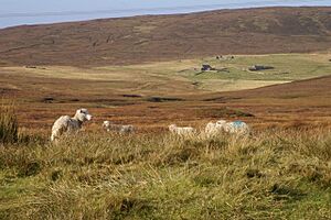
There isn't much farmland on Yell. However, the coast is great for fishing. Most of Yell's interior is covered by a thick layer of peat. This peat can be as deep as 10 feet (3 meters). It has formed over 3,000 years. Peat holds a lot of water but can be easily worn away, especially near the coast. Some streams on the island have carved deep gorges. These areas are home to many wild flowers and birds.
Yell was once divided into three church areas: North Yell, Mid Yell, and South Yell. Today, it is one civil parish called Yell. The island acts as a natural barrier. It separates the northern part of the North Sea to the east from the North Atlantic Ocean to the west.
Some popular places on Yell include the Sands of Breckon. This beach is made of crushed shells. Another interesting spot is the Daal of Lumbister gorge.
Main Settlements on Yell
Most of the towns and villages on Yell are located along the coast. These include Burravoe, where the Old Haa Museum is found. Other settlements are Mid Yell, Cullivoe, and Gloup. You can also find Ulsta, Gutcher, Aywick, West Yell, Sellafirth, Copister, Camb, Otterswick, and West Sandwick.
The west coast has very few modern settlements. This is mainly because of the strong winds and high cliffs. There are some small farms along Whale Firth. At Grimister, you can see the ruins of an old herring processing factory. It closed after World War II.
Islands Around Yell
Many smaller islands surround Yell. These include Aastack, Bigga, Black Skerry, Brother Isle, Brough, Burravoe Chest, Fish Holm, Gloup Holm, Gold Skerry, Green Holm, Grey Stack, Hascosay, Holm of West Sandwick, Horns of the Roe, Kay Holm, Linga, Muckle Holm, Neapback Skerries, Orfasay, Outsta Ness, Rug, Skerry Wick, Stacks of Stuis, Sweinna Stack, The Clapper, The Quidin, Whalegeo Stacks, Whilkie Stack, and Ern Stack.
Understanding Yell's Geology and Soils
Yell is located east of a major geological feature called the Walls boundary fault. Several large faults shape Yell's geography. The Bluemull Fault separates Yell from Unst. The Arisdale Fault forms part of Whale Firth. The Nesting Fault largely creates Yell Sound and divides Yell from Mainland Shetland. These faults were made even bigger by glaciers.
The island's main rock type is Moine schist. This is a metamorphosed sedimentary rock. It formed in shallow water about 1,000 to 800 million years ago. Then, it was lifted and changed during the Caledonian orogeny (mountain building) 600 to 400 million years ago. The main minerals in these rocks are quartzite, quartz-feldspar gneiss, and mica schist.
Like the rest of Scotland, Yell was covered by thick ice sheets during the Pleistocene ice ages. Some of the island's gorges, like the Daal of Lumbister, might have been formed by ancient meltwater streams. These streams flowed from under melting glaciers. Some of Yell's lochs (lakes) were likely dammed by piles of rock and dirt left by glaciers.
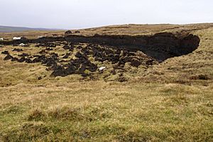
After the ice melted, a huge tsunami hit the island about 8,000 years ago. This was caused by the Storegga Slides. The floodwaters would have reached 25 meters (82 feet) above normal high tides. There is also some evidence of a more recent similar event at Basta Voe. Today, the non-porous rock, clay, and cool, damp climate have created large areas of peat. This peat covers two-thirds of the island. It averages 1.5 meters (5 feet) deep. It is made mostly of sphagnum moss, cotton grass, deer grass, heather, and sedge. This peat is very important to islanders as a source of fuel. In some areas, it is even sold commercially.
Near West Sandwick, there is a rare dune habitat. This is quite unusual for the Shetland Islands. There has been some debate about removing sand from this area for commercial use. This could have a big impact on the environment.
A Look at Yell's History

The name Yell has several possible meanings. It was recorded as Iala in the 1300s. It might come from an old British word meaning "unfruitful land." The Old Norse name was Jala or Jela, which could mean 'white island' because of its beaches. Another Old Norse name was Gjall, meaning 'barren'. In earlier times, it was sometimes written as "Zell." This was a mistake when copying the old letter yogh.
Early Times on Yell
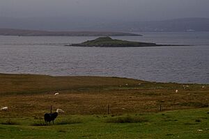
Yell has been lived in since the Neolithic period (New Stone Age). A stone footprint at North Yell, called the 'Wartie', was believed to cure warts. Legend says a giant made it by stepping there.
Archaeologists have found twelve broch sites and fifteen early chapels. This suggests that many people lived on Yell before the Norse arrived. One of these brochs is Burra Ness Broch. Only part of its wall remains, standing about 3 meters (10 feet) high. The name Burravoe comes from a nearby broch.
Place names on Yell show that the Celtic Church was present. Its hermits were called papar by the Norse. Names like Papil Ness and Loch of Papil come from them. It's not clear if these names are from before the Norse arrived. It's also unknown if Christians and pagan Norse people lived together after the Norse invasion. There is evidence of an early monastery at the Birrier in west Yell.
The Norse Era
Yell Sound is mentioned in the Orkneyinga saga, an old Norse story. It tells of Earl Rögnvald sailing into Alasund (Yell Sound) with his ships.
During the later Norse period, Christianity grew on Yell. The foundations of 20 chapels from this time have been found. The Norse left behind many place names. For example, "Dalsetter" combines a Norse or Old English word for "valley" with a Norse word for "hill pasture." "Whale Firth" uses "firth," which comes from Old Norse. "Gloup Voe" uses "voe," another Old Norse word for an inlet.
Trade and Modern History
Burravoe was an important trading center for the Hanseatic League. This was a powerful group of trading cities in Europe. In the 17th century, a Dutch ship called Lastdrager was shipwrecked on Yell. A survivor, Jan Camphuis, wrote about the kindness of the islanders.
In the 18th century, Johnnie Notions successfully gave early smallpox vaccinations on Yell. This was at a time when many places were still unsure about them. In 1881, a terrible storm off Gloup killed 53 fishermen. There is now a memorial there to remember them.
During World War I, Germans claimed their U-boats (submarines) hid in Whale Firth. This was possible because very few people lived in that area. In World War II, the Luftwaffe (German air force) bombed the post office at Gutcher. They wanted to disrupt communications. On January 19, 1942, a Catalina airplane crashed on a hill above Burravoe. Seven of the ten people on board died. One of its propellers is now outside the Old Haa Museum.
After World War II, the herring processing factory at Grimister closed. This was one of many economic problems for the island. In the 1960s, Yell faced challenges with people moving away. Some people commute to work at Sullom Voe, a large oil terminal. However, this industry is declining.
Yell's Amazing Plants and Animals
The coastline of Yell has many narrow inlets called voes. These are great places to see otters and different seabirds. You can find Brown trout in the island's freshwater lochs.
Mammals on Yell
Yell calls itself the "Otter Capital of Britain." The island's low-lying shore and soft, peaty soil are perfect for otters to dig their burrows. The long summer days also make it easier to spot these animals. They are usually active at night. A documentary about otters, The Track of the Wild Otter, was filmed at Burra Ness. Grey and common seals also visit Yell's coast often. Sometimes, rare Arctic animals like the bearded seal visit Yell. Normally, these seals live on pack ice.
Yell has its own special type of field mouse. Other Shetland Islands and St Kilda also have their own unique mouse types. Porpoises are sometimes seen near the island too.
Birds of Yell
A group of Arctic terns, called tirricks by locals, fly to Shetland from Antarctica every summer. Just as swallows signal summer elsewhere, the terns do this for Yell and Shetland.
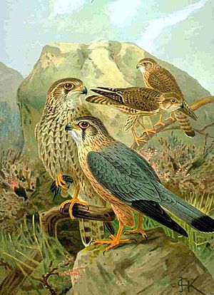
Other birds that regularly visit Yell include great and Arctic skuas. You can also see various terns, eider ducks, Eurasian whimbrels, red-throated divers, dunlins, golden plovers, twites, lapwings, and merlins. The Eigg and Ern Stack in northwest Yell were the last known nesting sites for Shetland sea eagles. They were last seen nesting there in 1910.
Yell's Flora (Plants)
Yell has many plants typical of northern European moorland. Heather grows in large amounts. There are also two carnivorous plants: the butterwort and the sundew. A study of plants on Yell's dry stone walls found that Lichens, especially Ramalina species, were the most common.
The island's gorges, like the Daal of Lumbister, are important for some of the few trees on Yell. This is because sheep cannot graze there. Before humans settled on the island, Yell likely had some dwarf trees and shrubs. In the gorge at the head of Gloup Voe, you can find dog roses and honeysuckle. The peat on the island preserves old plants and pollen. This helps scientists understand what the island's plants were like in the past. For example, 40,000 years ago, before the last ice age, oak trees, Scots pines, and Mediterranean heathers grew here.
Getting Around Yell
Yell is a central point for travel to the nearby islands of Unst and Fetlar.
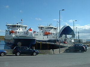
The Yell Sound Ferry travels from Ulsta on Yell to Toft on the Shetland Mainland. Two ferries, Daggri and Dagalien, operate this service. They were built in Gdańsk, Poland. Each ferry can carry 31 cars or 4 trucks, and 95 passengers. The trip takes about 20 minutes. Ferries leave about every half-hour during busy times.
The Bluemull Sound Ferry goes from Gutcher on Yell to Belmont on Unst and Oddsta on Fetlar. Ferries go to Unst about every half-hour during the day. They go to Fetlar a few times each day. The trip to Unst takes ten minutes, while the trip to Fetlar takes 25 minutes. The ferries Bigga and Geira operate this service.
Yell has two main roads: the A968 and the B9081. The A968 connects the ferry terminals. It runs from Ulsta in the southwest to Gutcher in the northeast. Even though it's an A road, some parts are single track with passing places. The B9081 is also a single-track road with passing places. It runs along the south and east coasts of Yell.
Yell's Economy and Industries
Yell's main industries include fishing and fish farming. People also do farming, including growing strawberrys in polytunnels for the local Shetland market. Other industries are peat cutting, transport, and tourism.
Cullivoe got a new deep water harbor in 1991. However, the decline in fish stocks in the North Sea and North Atlantic has made it less useful for fishing. It might be used more for transport in the future.
In 2008, the Shetland Development Trust helped Global Yell Ltd. This company works on "creative industries" like textile weaving and music.
In April 2014, the "world's first community-owned tidal power generator" started working in Bluemull Sound. This turbine generates 30 kilowatts of power. The North Yell Development Council believes this project can greatly help the local economy.
Interesting Buildings and Structures
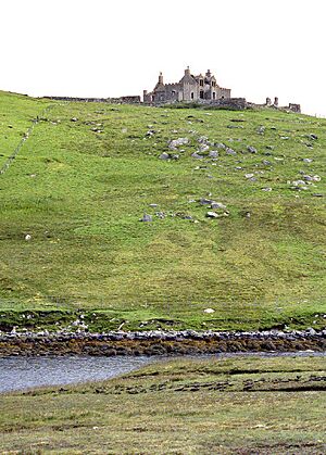
Windhouse is a ruined stone building from 1707. It is said to be the most haunted house in Shetland. When it was renovated in 1880, skeletons were found under the floor. After being empty for over 80 years, it was bought in 2003. However, no restoration has happened, and it is now for sale again.
Windhouse Lodge is a strong gatehouse near Windhouse. It is run by the Shetland Amenity Trust as a camping Böd. This böd offers accommodation for up to eight people in three bedrooms. It has hot water, a shower, cooking tools, a fridge, microwave, and a small cooker.
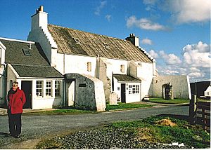
The Old Haa of Brough in Burravoe is a large merchant's house built in 1672. It is now a museum and visitor center.
At Kirkabister, you can see the remains of an old pony stud. The enclosure is unusual because its four corners are slightly raised. There are only a few such enclosures in Shetland.
Yell's Folklore and Legends
At Breckon, there's a story about an old grave. When it was dug up, several human skeletons were found. One skeleton was said to be at least seven feet tall. It also had small, stumpy "horns" above its temples. It's unclear if this is a true story or just a legend.
Like many Nordic lands, Yell has its trolls. In the Northern Isles, they are called "trows" or "trowes." The Trow of Windhouse was seen as recently as the 1880s. A sailor who was shipwrecked claimed a mythical monster attacked him. The brave sailor fought the creature with an axe. It is said that where he killed the trow, the grass turned a light green. There's another story about a Yell woman who met a family of trowes. Later, she found one in her house. When she asked who he was, he said, "I am Trippa's son." The woman said a prayer, and the trow disappeared.
Yell in Literature
George MacKay Brown's Poem
George Mackay Brown, a poet from Orkney, wrote a poem with a Yell-man from 1263 as the narrator.
- I am a farmer from Yell in Shetland.
- Bjorn my mother called me.
Bjorn grows up among "seals and clouds and birds and women" on the island. But this peaceful life is contrasted with his father. His father was a Viking pirate, covered in scars, who "harvested" silver.
Jim Crumley and Among Islands
Jim Crumley is a writer from Dundee. He bought a partly ruined cottage on Yell. He has written a lot about Yell in his book Among Islands (1994). This book covers many islands, from St Kilda to Shetland. He said his interest in islands started when he saw Inchcape in the distance as a teenager. He worked for over twenty years for newspapers, writing about Scottish wildlife and landscapes. His later books are about Scottish islands and mountains.
Crumley once said, "You could never argue with conviction that Yell is a beautiful place." However, he still has a strong affection for the island. He sees Yell as an important part of Shetland. He wrote:
- "It works because of where it is, an island among islands, a perfectly sealed lynchpin, which makes geographical sense of Shetland, and without which the whole archipelago would slide out of kilter and slither uncontrollably into the sea."
As someone who moved to Yell, he also wrote about the challenges the island faces. These include people moving away and new people moving in. He noted that "good intentions do not turn an incomer into a son of the island soil."
See also
 In Spanish: Yell para niños
 | Charles R. Drew |
 | Benjamin Banneker |
 | Jane C. Wright |
 | Roger Arliner Young |


