Jirishanca facts for kids
Quick facts for kids Jirishanca |
|
|---|---|

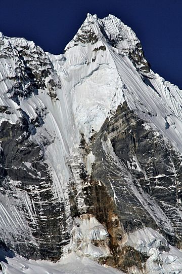
Jirishanca, West Face, July 2010
|
|
| Highest point | |
| Elevation | 6,125 m (20,095 ft) |
| Prominence | 484 m (1,588 ft) |
| Parent peak | Yerupaja |
| Geography | |
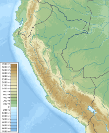
| Location | Ancash Region, Peru |
| Parent range | Andes, Huayhuash |
| Climbing | |
| First ascent | 12 July 1957 - Toni Egger and Siegfried Jungmeir (Austria) - Toni Egger and Siegfried Jungmeir (Austria) |
Jirishanca is a very tall mountain in west-central Peru. It is part of the Andes mountain range, specifically in the Huayhuash area. It stands about 6,094 meters (or 6,125 meters, depending on the source) high.
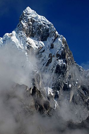
Jirishanca is the tenth highest mountain in Peru. It is also the third highest in the Huayhuash range, after Yerupajá and Siula Grande. The name "Jirishanca" means "hummingbird bill peak." This is because its sharp, pointed shape looks a bit like a hummingbird's beak!
Climbing Jirishanca
Jirishanca is known for being a very difficult mountain to climb. Not many people have successfully reached its top. It is considered one of the hardest 6,000-meter mountains in the Andes.
The easiest way to climb Jirishanca is still very challenging. It is rated as a "TD" route, which means "Très Difficile" (very difficult) in climbing terms. There are even harder routes, some with vertical ice walls and tricky sections. For example, the "Cassin route" has ice sections that are 70 degrees steep!
First Climbs
The very first time someone climbed Jirishanca was in July 1957. Two Austrian climbers, Toni Egger and Siegfried Jungmair, made this amazing climb. They went up the northeast side of the mountain. Their climb was so brave and difficult that it's called "one of the boldest climbing feats ever" in the area. Their specific path has only been climbed one other time since!
Other climbers have also tried different ways to reach the top:
- In 1964, Americans Gary Colliver and Glen Denny climbed part of the mountain.
- On July 6, 1969, an Italian team led by Riccardo Cassin found a new way up the West face.
- On July 31, 1971, Americans Dean Caldwell and Jon Bowlin climbed the southwest face. They did it in just two days!
- In 1973, a Japanese team led by Masayuki Shinohara climbed the southeast face for the first time. This climb was very long and took them 49 days!
How Tall is Jirishanca?
The exact height of Jirishanca has been measured differently over time. Some sources say it is 6,125 meters tall. However, other modern measurements using digital maps show it might be a bit lower, around 6,028 meters or even 5,734 meters.
The mountain's "topographic prominence" is 484 meters. This means it rises 484 meters from the lowest point connecting it to a higher mountain. Jirishanca's closest taller neighbor is Yerupajá, which is about 3.5 kilometers away.
See also
 In Spanish: Jirishanca para niños
 | John T. Biggers |
 | Thomas Blackshear |
 | Mark Bradford |
 | Beverly Buchanan |


