Kaiser Point (Montana) facts for kids
Quick facts for kids Kaiser Point |
|
|---|---|

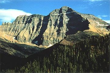
Mount Cleveland at right and Kaiser Point is far point on ridgeline at left
|
|
| Highest point | |
| Elevation | 10,001 ft (3,048 m) |
| Prominence | 596 ft (182 m) |
| Geography | |
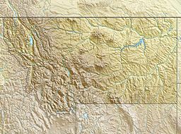
| Location | Glacier County, Montana, U.S. |
| Parent range | Lewis Range |
| Topo map | USGS Mount Cleveland MT |
| Climbing | |
| Easiest route | class IV-V |
Kaiser Point is a tall mountain peak found in Glacier National Park in Montana, U.S.. It is part of the Lewis Range. This peak reaches about 10,001 feet (3,048 m) into the sky. It is a notable landmark in the park.
About Kaiser Point
Kaiser Point is one of the highest peaks in Glacier National Park. Its official height is 10,001 feet (3,048 m). This measurement comes from a newer system called the North American Vertical Datum of 1988. Older maps might show a slightly different height.
Its Place Among Peaks
Glacier National Park is home to many tall mountains. The park service says there are six peaks over 10,000 feet (3,048 m). Kaiser Point is often listed as the seventh tallest peak in the park. This makes it a very impressive mountain.
Close to the Tallest
Kaiser Point is very close to Mount Cleveland. Mount Cleveland is the tallest mountain in all of Glacier National Park. Kaiser Point is only about .67 miles (1.08 km) northeast of Mount Cleveland. This means you can often see both peaks together.
 | Ernest Everett Just |
 | Mary Jackson |
 | Emmett Chappelle |
 | Marie Maynard Daly |


