Kangiqhuk facts for kids
Quick facts for kids Kangiqhuk |
|
|---|---|

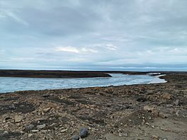
Looking to the west and the head of the fiord.
|
|
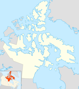
| Location | Victoria Island, Nunavut |
| Coordinates | 69°06′23″N 105°09′26″W / 69.10639°N 105.15722°W |
| Ocean/sea sources | Cambridge Bay |
| Basin countries | Canada |
| Settlements | Cambridge Bay |
Kangiqhuk is a special type of inlet from the sea, often called a fiord. It's located on the southeast coast of Victoria Island in Canada's Nunavut territory. This fiord was once known as West Arm.
Kangiqhuk is quite short, stretching about 5 kilometers (3 miles). It flows into a larger body of water called Cambridge Bay. From there, the water continues into Dease Strait and then into Queen Maud Gulf.
The small community of Cambridge Bay is very close to Kangiqhuk. The Cambridge Bay Airport is also found on the northern side of this fiord.
Contents
What is a Fiord?
A fiord is a long, narrow, and deep inlet of the sea. It is typically found between high, steep cliffs. Fiords are formed by glaciers that carved out valleys during the Ice Ages. When the glaciers melted, the sea filled these valleys.
How Fiords Are Formed
Imagine a giant river of ice, called a glacier, slowly moving across the land. As it moves, it scrapes away rock and soil. This process creates a U-shaped valley. When the climate warms up, the glacier melts. The ocean then floods the valley, creating a fiord.
Kangiqhuk's Location
Kangiqhuk is located in the Canadian Arctic. This area is known for its cold climate and unique landscapes. Victoria Island is one of the largest islands in Canada. It is part of the Arctic Archipelago.
Victoria Island's Geography
Victoria Island is a vast land of tundra, lakes, and rivers. The landscape is mostly flat or gently rolling. It is home to many animals adapted to the cold. The island is largely uninhabited by people.
Nearby Community: Cambridge Bay
Cambridge Bay is a small hamlet located near Kangiqhuk. It is one of the largest communities in Nunavut. It serves as an important center for the surrounding region. Many people who live here are Inuit, the Indigenous people of the Arctic.
Life in Cambridge Bay
Life in Cambridge Bay is closely tied to the land and sea. People often hunt, fish, and trap. The community has a school, a health center, and a small airport. The airport connects Cambridge Bay to other parts of Canada. It is also important for delivering supplies.
 | William L. Dawson |
 | W. E. B. Du Bois |
 | Harry Belafonte |


