Kanorado, Kansas facts for kids
Quick facts for kids
Kanorado, Kansas
|
|
|---|---|

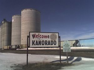
Kanorado Welcome Sign (2008)
|
|

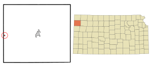
Location within Sherman County and Kansas
|
|

|
|
| Country | United States |
| State | Kansas |
| County | Sherman |
| Township | Stateline |
| Founded | 1880s |
| Incorporated | 1920 |
| Named for | two states |
| Area | |
| • Total | 0.26 sq mi (0.68 km2) |
| • Land | 0.26 sq mi (0.68 km2) |
| • Water | 0.00 sq mi (0.00 km2) |
| Elevation | 3,908 ft (1,191 m) |
| Population
(2020)
|
|
| • Total | 153 |
| • Density | 588/sq mi (225.0/km2) |
| Time zone | UTC-7 (Mountain (MST)) |
| • Summer (DST) | UTC-6 (MDT) |
| ZIP code |
67741
|
| Area code | 785 |
| FIPS code | 20-35975 |
| GNIS ID | 471238 |
Kanorado is a small city in Sherman County, Kansas, United States. Its name is a mix of "Kansas" and "Colorado." This is because it is located very close to the border between the two states. In 2020, about 153 people lived in Kanorado.
Contents
History of Kanorado
The first post office in the area opened in 1889. It was first called Lamborn until 1903, when its name changed to Kanorado.
On February 10, 2016, the Kansas House of Representatives made a special declaration. They named Kanorado the Top City of Kansas. This is because it is the highest city in the state, sitting at 3,907 feet (about 1,191 meters) above sea level.
Geography and Location
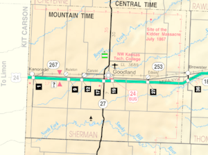
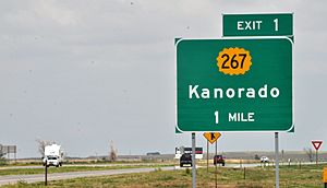
Kanorado is located in Sherman County, in the western part of Kansas. You can find it at 39°19′59″N 102°2′17″W / 39.33306°N 102.03806°W. It is the very first exit (Exit 1) off Interstate 70 in Kansas when you enter Kansas from Colorado.
The city covers a total area of about 0.26 square miles (0.68 square kilometers). All of this area is land. In 1873, a history book described the county as very flat and mostly without trees. Several rivers and creeks start or pass through this area. Farmers in the region often use irrigation to grow their crops.
Population and People
| Historical population | |||
|---|---|---|---|
| Census | Pop. | %± | |
| 1930 | 359 | — | |
| 1940 | 322 | −10.3% | |
| 1950 | 285 | −11.5% | |
| 1960 | 245 | −14.0% | |
| 1970 | 278 | 13.5% | |
| 1980 | 217 | −21.9% | |
| 1990 | 276 | 27.2% | |
| 2000 | 248 | −10.1% | |
| 2010 | 153 | −38.3% | |
| 2020 | 153 | 0.0% | |
| U.S. Decennial Census | |||
2020 Population Data
The 2020 United States census counted 153 people living in Kanorado. There were 61 households and 44 families. Most residents, about 74.5%, were white. About 29.4% of the population identified as Hispanic or Latino.
About 28.8% of the people were under 18 years old. The average age in the city was 44.5 years.
2010 Population Data
In 2010, the city also had 153 people. There were 73 households. About 23.3% of these households had children under 18. The average household had 2.10 people.
The median age in 2010 was 50.3 years. About 20.3% of residents were under 18.
Education
Students in Kanorado attend schools in the Goodland USD 352. Kanorado used to have its own high school. Its mascot was the bear. However, these schools were closed as part of a school unification plan.
Transportation and Roads
Railroad
The Kyle Railroad runs along the southern edge of the city.
Highways
Two major highways, ![]() I-70 and
I-70 and ![]() U.S. Route 24, pass east to west just south of Kanorado. An older part of
U.S. Route 24, pass east to west just south of Kanorado. An older part of ![]() U.S. Route 24 also runs near the city, parallel to the railway.
U.S. Route 24 also runs near the city, parallel to the railway. ![]() Kansas Highway 267 is a short road that connects the city to Interstate 70.
Kansas Highway 267 is a short road that connects the city to Interstate 70.
See also
 In Spanish: Kanorado (Kansas) para niños
 | Delilah Pierce |
 | Gordon Parks |
 | Augusta Savage |
 | Charles Ethan Porter |


