Kayes Region facts for kids
Quick facts for kids
Kayes Region
|
|
|---|---|
|
Region
|
|
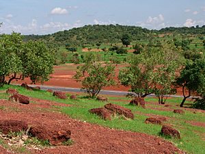
Sahel forest
|
|
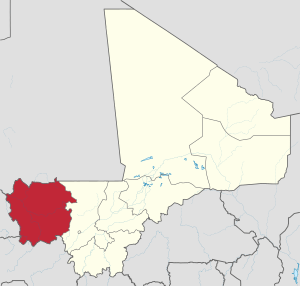
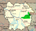
Location within Mali
|
|
| Country | |
| Capital | Kayes |
| Area | |
| • Total | 119,743 km2 (46,233 sq mi) |
| Population
(2009 census)
|
|
| • Total | 1,996,812 |
| • Density | 16.67581/km2 (43.19016/sq mi) |
| Time zone | UTC±0 (UTC) |
| HDI (2017) | 0.387 low |
The Kayes Region is a big area in Mali, a country in West Africa. It is one of eight main parts of Mali called "Regions." Kayes Region was the first area to be set up as an administrative region in Mali. It covers about 120,760 square kilometers. The main city and capital of this region is Kayes. Long ago, this area was part of important empires like the Ghana Empire and the Mali Empire.
Contents
Geography and People
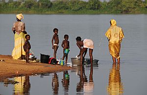
In 2009, about 1,996,812 people lived in the Kayes Region. Many different groups of people call this region home. These include the Soninkés, Khassonkés, Malinkés, Dialonkés, and Fulas.
Rivers and Climate
Several important rivers flow through the region. These are the Baoulé, the Bafing, and the Bakoy. These three rivers meet near the town of Bafoulabé to form the big Sénégal River.
Near the border with Guinea, the weather is quite wet. As you go north, the climate changes. It becomes more like the Sudanian area, which is drier. Even further north, it turns into a Sahelian climate, which is very dry.
Major Cities and Parks
The largest cities in the Kayes Region are Kayes, Kita, Bafoulabé, Nioro du Sahel, Diéma, Yélimané, Sadiola, and Kéniéba. The region is also home to two national parks: the Bafing National Park and the Boucle du Baoulé National Park. These parks help protect the local wildlife and nature.
History of Kayes Region
The Kayes Region is known as the birthplace of the Kingdom of Khasso. This kingdom was started in the early 1800s.
French Influence
In 1855, Louis Faidherbe, who was the Governor of Senegal, built a fort at a place called Medina. A few years later, in 1857, a leader named El Hadj Omar Tall attacked this fort during a war against the ruler of Khasso.
Later, in 1892, the town of Kayes became the capital of what was then called French Sudan. This was a big deal for the town.
The Railway's Impact
A very important event for Kayes was the building of the railway line of Dakar-Niger. This train line was officially opened in 1904. It made Kayes a major crossroads city. The railway was super important for the people living there. It played a huge part in their daily lives and helped the city grow.
Images for kids
See also
 In Spanish: Región de Kayes para niños
 | Selma Burke |
 | Pauline Powell Burns |
 | Frederick J. Brown |
 | Robert Blackburn |


