Sahel facts for kids
Quick facts for kids Sahel |
|
|---|---|
|
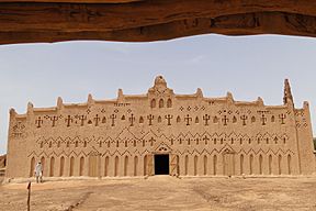
Throughout the Sahel, rammed earth construction is widespread, as exemplified by this medieval mosque in Burkina Faso
|
|
|
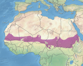
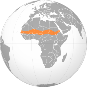
The Sahel region in Africa: a belt up to 1,000 km (620 mi) wide that spans 5,400 km (3,360 mi) from the Atlantic Ocean to the Red Sea
|
|
| Ecology | |
| Realm | Afrotropical |
| Biome | Tropical and subtropical grasslands, savannas, and shrublands |
| Borders |
List
|
| Animals | Camels, horses |
| Bird species | Migratory birds |
| Mammal species | Oryx, Gazelles, African buffalo |
| Geography | |
| Area | 3,053,200 km2 (1,178,800 sq mi) |
| Countries | |
| Elevation | 200 and 400 meters (660 and 1,310 ft) |
| Rivers | Senegal, Niger, Nile |
| Climate type | Tropical savanna climates (Aw), Hot Semi-arid (BSh), Hot Desert (BWh) |
The Sahel region is a special part of Africa. It's also called the Sahelian acacia savanna. It's a transition zone (a place where two different areas meet) between the wetter Sudanian savannas in the south and the dry Sahara Desert in the north. The Sahel has a hot, semi-dry climate. It stretches across the southern parts of North Africa, from the Atlantic Ocean to the Red Sea. Even though it's in the tropics, its climate isn't truly tropical.
In some parts of the Sahel, especially the west, there are often shortages of food and water. This is made worse by a fast-growing population. In recent times, some countries in the Sahel have faced challenges like conflicts and unrest.
Contents
Geography of the Sahel
The Sahel stretches about 5,900 km (3,670 mi) from the Atlantic Ocean in the west to the Red Sea in the east. It forms a belt that is several hundred to a thousand kilometers wide. The total area of the Sahel is about 3,053,200 square kilometers (1,178,850 sq mi).
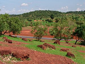
This region is a transition zone between the wetter Sudanian savannas to the south and the very dry Sahara Desert to the north. It has hot, semi-desert and steppe conditions. This area is also known as the Sahelian Acacia savanna because of its many acacia trees, which can handle dry weather very well.
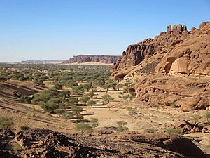
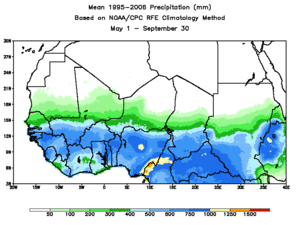
The land in the Sahel is mostly flat. Most of the region is between 200 and 400 meters (660 and 1,310 ft) high. Some isolated plateaus and mountains rise from the Sahel, like the Marrah Mountains or Aïr Mountains. However, these are considered separate areas because their plants and animals are different from the surrounding flatlands. The amount of rain changes across the Sahel. It gets about 100–200 mm (4–8 in) of rain in the north and about 700–1,000 mm (28–39 in) in the south each year.
Plants and Animals in the Sahel
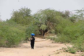
The Sahel is mostly covered with grasslands and savannas, along with some woodlands and shrublands. Grasses like Cenchrus biflorus and Aristida stipoides are common. Acacia trees are the main type of tree, with Acacia tortilis being the most widespread. Other trees include the famous Adansonia digitata (baobab) and Balanites aegyptiaca. During the long dry season, many trees lose their leaves, and most of the grasses die.
The Sahel used to have many large grazing animals. These included the scimitar oryx, dama gazelle, and Dorcas gazelle. There were also large predators like the African wild dog, cheetah, and lion. Sadly, hunting and competition with farm animals have greatly reduced their numbers. Some species are now vulnerable, endangered, or even extinct. For example, the scimitar-horned oryx is likely extinct in the wild.
The wetlands in the Sahel are very important for migratory birds. These birds travel through Africa and along routes between Africa and Europe/Asia.
Climate of the Sahel
The Sahel has a hot semi-arid climate. This means it's usually hot, sunny, dry, and a bit windy all year. The climate is similar to the Sahara Desert to the north, but not as extreme.
The Sahel generally gets a low amount of rain each year. It has a very long dry season and a short rainy season. The amount of rain can also change a lot from year to year. Most of the rain falls during four to six months in the middle of the year, while other months can be completely dry. The central Sahel usually gets between 200 mm and 700 mm of rain annually. The air in the Sahel is usually very dry, especially during the dry season.
The Sahel is always very hot. Temperatures rarely get cold. During the hottest time, average high temperatures are usually between 36 and 42 °C (97 and 108 °F). Even during the "coldest" time, average high temperatures are still between 27 and 33 °C (81 and 91 °F). The average temperature in the Sahel is always above 18 °C (64 °F).
The Sahel gets a lot of sunshine throughout the year, similar to deserts. The sky is usually clear with very few clouds. For example, Niamey, Niger, gets over 3,000 hours of bright sunshine each year.
Recent Droughts
The Sahel region has faced many droughts (periods of very little rain) over hundreds of years. One very long drought lasted for 250 years, from 1450 to 1700. A major drought in 1914 caused a large famine because there wasn't enough rain for crops.
From 1951 to 2004, the Sahel had some of the worst droughts in Africa. In the 1960s, there was more rain, which encouraged people to move north into drier areas. But when a long drought began in 1968 and lasted until 1974, there wasn't enough grass for animals, and the land became bare. This led to another large famine. This disaster led to the creation of the International Fund for Agricultural Development, which helps farmers in poor countries.
The 2010 Drought
Between June and August 2010, another famine hit the Sahel. In Niger, crops failed due to the heat, leaving many people without food. Temperatures reached record highs in countries like Chad and Niger. For example, in Bilma, Niger, the temperature reached 48.2 °C (118.8 °F). Many children became sick or died from dehydration, diarrhea, and malnutrition. Local governments asked for international help to provide food.
Desertification and Soil Loss
The Sahel faces big environmental problems, including desertification (when fertile land turns into desert). If this change isn't stopped, and if more trees aren't planted, countries like Niger could lose all their land to the desert. Too much farming, too many animals grazing, and too many people living on fragile lands, along with natural soil erosion, have caused serious desertification.
A big project called the Great Green Wall is trying to fight desertification in the Sahel. It involves planting many trees and using other methods to restore the land.
Large dust storms are also common. These storms can carry dust for long distances. For example, in November 2004, major dust storms hit Chad, coming from the Bodélé Depression. This area has dust storms about 100 days a year.
In March 2010, a big sandstorm hit several countries, including Mauritania, Senegal, and Mali.
However, after the droughts of the 1970s and 1980s, the Sahel started to get more rain. This might be linked to global warming, which can change weather patterns, possibly leading to stronger monsoons (rainy seasons) due to warmer oceans.
Protected Areas
To protect its unique environment, the Sahel has several protected areas. These include:
- Ferlo Nord Wildlife Reserve in Senegal
- Sylvo-Pastoral and Partial Faunal Reserve of the Sahel in Burkina Faso
- Ansonga-Ménake Faunal Reserve in Mali
- Tadres Reserve in Niger
- Waza National Park in Cameroon
Culture and Lifestyle
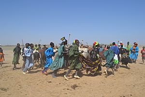
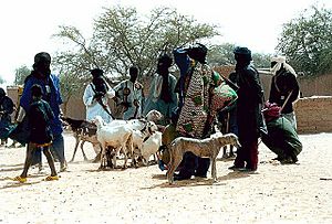
Traditionally, many people in the Sahel have been semi-nomads. This means they move with their livestock (like cows and goats) in a system called transhumance. They farm and raise animals. During the wet season, their herds graze in the north where the soil is richer. Then, during the dry season, they travel hundreds of kilometers south to find more grass, even if it's not as nutritious.
What "Sahel" Means
The word "Sahel" comes from the Arabic word al-sāḥil, which means "coast" or "shore." Some people think this refers to the Sahel being the "shore" or edge of the vast Sahara Desert. However, it might also come from another Arabic word, sahl, meaning "plain."
History of the Sahel
Early Farming
Around 4000 BC, the climate in the Sahara and Sahel started to become much drier. Lakes and rivers shrank, and more land turned into desert. This made it harder for people to live there, so farming communities moved to wetter areas in West Africa.
Sahelian Kingdoms
The Sahelian kingdoms were powerful states that existed in the Sahel from the 9th to the 18th centuries. Famous examples include the Mali Empire during the time of Mansa Musa. These kingdoms became rich by controlling the trans-Saharan trade routes across the desert, especially trade with North Africa.
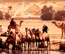
Their power came from having large pack animals like camels and horses. These animals were fast and helped them control large empires and were useful in battles. These empires were not very centralized; member cities often had a lot of freedom.
The larger Sahelian kingdoms grew from 750 AD. They built several big cities along the Niger River, such as Timbuktu, Gao, and Djenné. These kingdoms found it hard to expand into the forested areas to their south. This was because mounted warriors on horses and camels were not effective in thick forests, and the animals could get sick from the humidity and diseases of the tropics.
Colonial Period
In the late 1800s, the western part of the Sahel became part of French West Africa, controlled by France. Chad was added in 1900 as part of French Equatorial Africa. These French territories in the Sahel gained their independence in 1960.
The easternmost part of the Sahel was not taken over by European powers. Instead, it was conquered by Muhammad Ali of Egypt in the 1820s. Later, in 1899, it came under British rule until it became independent in 1956.
See also
 In Spanish: Sahel para niños
- Community of Sahel-Saharan States
- Great Green Wall
- 2010 Sahel famine
- Sahel drought
- Sudan (region)
- Sudanian savanna
- Semi-arid climate
- Trans-Sahelian Highway
- Desertification in Africa
 | Stephanie Wilson |
 | Charles Bolden |
 | Ronald McNair |
 | Frederick D. Gregory |


