Keeragh Islands facts for kids
|
Native name:
Oileáin na gCaorach
|
|
|---|---|

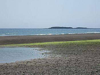
Viewed from Ballymadder Point
|
|
| Etymology | Islands of the sheep |
| Geography | |
| Location | Celtic Sea |
| Coordinates | 52°11′54″N 6°44′16″W / 52.1983°N 6.73778°W |
| Area | 2.38 ha (5.9 acres) |
| Highest elevation | 10 m (30 ft) |
| Administration | |
| County | Wexford |
| Demographics | |
| Population | 0 |
| Pop. density | 0 /km2 (0 /sq mi) |
The Keeragh Islands (in Irish: Oileáin na gCaorach) are two small islands. You can find them about 1.5 kilometers (1 mile) off the coast of Bannow. This area is in south County Wexford, Ireland.
These islands are a special place called a Natural Heritage Area. This means they are very important for nature. Many seabirds, like cormorants, come here to nest and raise their young. The islands are surrounded by a dangerous rocky reef. There is an old ruin on the larger island. It was built around 1800 to help people who survived shipwrecks. Today, it is very old and falling apart.
The Fethard Lifeboat Disaster of 1914
On February 20, 1914, a Norwegian ship called the Mexico got stuck. It ran aground on the rocky reef near the Keeragh Islands. The sea was very stormy that day. The Fethard lifeboat was sent out to help. Sadly, both the Mexico and the lifeboat were destroyed by huge waves.
Nine of the fourteen lifeboat crew members were lost in the storm. The remaining five crew members survived. They joined eight Norwegian sailors from the Mexico on the exposed reef. They had to hold onto the cold rocks while the storm continued.
A Brave Rescue Mission
Several attempts were made to rescue the people on the reef. But the storm was too strong. Finally, two very brave men stepped forward. Their names were Bill Duggan and Jim Wickham. They were from the Rosslare Fort lifeboat.
They took a small boat, called a dinghy, and went towards the reef. They ferried the survivors from the icy rocks, two people at a time. The rescue needed six trips in the stormy sea to bring everyone to safety. On the second trip, the dinghy got a hole in it! For the rest of the trips, they used a loaf of bread wrapped in oilskins to plug the hole. This amazing act of bravery saved many lives.
 | Selma Burke |
 | Pauline Powell Burns |
 | Frederick J. Brown |
 | Robert Blackburn |


