Kellogg, Iowa facts for kids
Quick facts for kids
Kellogg, Iowa
|
|
|---|---|
 |
|

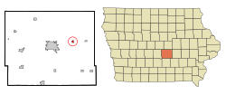
Location of Kellogg, Iowa
|
|
| Country | |
| State | |
| County | Jasper |
| Area | |
| • Total | 0.37 sq mi (0.96 km2) |
| • Land | 0.37 sq mi (0.96 km2) |
| • Water | 0.00 sq mi (0.00 km2) |
| Elevation | 896 ft (273 m) |
| Population
(2020)
|
|
| • Total | 606 |
| • Density | 1,633.42/sq mi (630.96/km2) |
| Time zone | UTC-6 (Central (CST)) |
| • Summer (DST) | UTC-5 (CDT) |
| ZIP code |
50135
|
| Area code(s) | 641 |
| FIPS code | 19-40440 |
| GNIS feature ID | 0458031 |
Kellogg is a small city located in Jasper County, Iowa, in the United States. In 2020, about 606 people lived there. The city was first called Manning's Station, then Jasper City, and Kimball, before finally being named Kellogg. It got its name from an early settler, Judge Abel Avery Kellogg.
Contents
History of Kellogg
Kellogg was planned in 1865 because a railroad, the Mississippi and Missouri Railroad, was going to be built through the area. When the railroad arrived in 1866, Kellogg became a station along the line. The railroad's end point stayed in Kellogg for a while, which helped the town grow quickly in its early days.
Today, one of the most interesting places in Kellogg is the Kellogg Museum complex. It has five buildings! The main building used to be the Simpson Hotel, built in 1909. The museum also has an old one-room schoolhouse and a country church, showing what life was like long ago.
Geography of Kellogg
Kellogg is located at 41°43′00″N 92°54′27″W / 41.71667°N 92.90750°W. This means it's in the central part of the United States.
The city covers a total area of about 0.96 square kilometers (0.37 square miles). All of this area is land; there are no large lakes or rivers within the city limits.
Highway 224 runs along the eastern side of Kellogg. The North Skunk River flows southeast along the southern edge of the town.
ZIP Codes and Streets
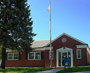
All addresses in Kellogg use the 50135 ZIP code. Many people in Kellogg get their mail at a post office box instead of having it delivered to their homes.
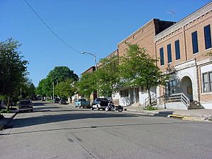
Kellogg's streets are named, like "Adair St." House numbers start at the southeast corner of the town. They get bigger as you move west or north. The main business area, including the Kellogg Museum complex, is located on High St.
Population and People
| Historical populations | ||
|---|---|---|
| Year | Pop. | ±% |
| 1880 | 772 | — |
| 1890 | 700 | −9.3% |
| 1900 | 653 | −6.7% |
| 1910 | 610 | −6.6% |
| 1920 | 603 | −1.1% |
| 1930 | 580 | −3.8% |
| 1940 | 648 | +11.7% |
| 1950 | 670 | +3.4% |
| 1960 | 623 | −7.0% |
| 1970 | 607 | −2.6% |
| 1980 | 654 | +7.7% |
| 1990 | 626 | −4.3% |
| 2000 | 606 | −3.2% |
| 2010 | 599 | −1.2% |
| 2020 | 606 | +1.2% |
| Source: and Iowa Data Center Source: |
||
2020 Census Data
According to the census from 2020, 606 people lived in Kellogg. There were 262 households and 158 families. The city had about 631 people per square kilometer (1,634 per square mile). There were 288 housing units, which are places where people live.
Most of the people in Kellogg (94.1%) were White. A small number were Native American (0.5%), Asian (0.8%), or from other backgrounds. About 2.1% of the population were Hispanic or Latino.
About 29% of the households had children under 18 living with them. The average age of people in Kellogg was 42.9 years old. About 22.3% of residents were under 20, and 18.8% were 65 or older. The population was almost evenly split between males (51.2%) and females (48.8%).
2010 Census Data
In the 2010 census, there were 599 people living in Kellogg. There were 261 households and 160 families. The population density was about 627 people per square kilometer (1,619 per square mile).
Most people (98.2%) were White. About 2.2% of the population were Hispanic or Latino.
About 26.4% of households had children under 18. The average age in the city was 40.6 years. About 20.9% of residents were under 18, and 12.7% were 65 or older. The city had slightly more males (50.4%) than females (49.6%).
See also
 In Spanish: Kellogg (Iowa) para niños
 | Madam C. J. Walker |
 | Janet Emerson Bashen |
 | Annie Turnbo Malone |
 | Maggie L. Walker |


