Kenly, North Carolina facts for kids
Quick facts for kids
Kenly, North Carolina
|
|||
|---|---|---|---|
 |
|||
|
|||
| Motto(s):
"Friendly"
|
|||
| Country | United States | ||
| State | North Carolina | ||
| Counties | Johnston, Wilson | ||
| Area | |||
| • Total | 1.82 sq mi (4.71 km2) | ||
| • Land | 1.81 sq mi (4.70 km2) | ||
| • Water | 0.00 sq mi (0.01 km2) | ||
| Elevation | 200 ft (60 m) | ||
| Population
(2020)
|
|||
| • Total | 1,491 | ||
| • Density | 821.49/sq mi (317.10/km2) | ||
| Time zone | UTC-5 (Eastern (EST)) | ||
| • Summer (DST) | UTC-4 (EDT) | ||
| ZIP code |
27542
|
||
| Area code(s) | 919 | ||
| FIPS code | 37-35540 | ||
| GNIS feature ID | 2405935 | ||
Kenly is a small town located in North Carolina, a state in the United States. It is found in parts of both Johnston and Wilson counties. The town was named after John R. Kenly, who was an important leader for the Atlantic Coast Line Railroad. He later became the president of the railroad in 1913. In 2020, about 1,491 people lived in Kenly.
Contents
History of Kenly
The area where Kenly is now located was first settled around 1875. It grew up around a special "Short-Cut" rail line of the Wilmington and Weldon Railroad. In 1887, Kenly officially became a town. It was named after J. R. Kenly, a railroad official.
The town's first school, Kenly Academy, opened in 1897. This was a private school where students could also live. Later, in 1914, Kenly High School, a public school, was opened for everyone. That same year, the town also got its first electric service, which was a big step forward!
Geography of Kenly
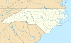
Kenly is mostly located in the eastern part of Johnston County. A small section of the town also reaches into the southwest corner of Wilson County.
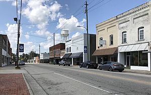
The main road that goes through the middle of Kenly is U.S. Route 301, also known as Church Street. Another important road, North Carolina Highway 222 (Second Street), crosses US 301 right in the town center. If you are traveling on Interstate 95, which runs along the northwest side of Kenly, you can get into town using Exit 107 (US 301).
The United States Census Bureau says that Kenly covers a total area of about 4.71 square kilometers (1.82 square miles). Most of this area is land, with only a very small part being water.
Population and People
| Historical population | |||
|---|---|---|---|
| Census | Pop. | %± | |
| 1890 | 137 | — | |
| 1900 | 260 | 89.8% | |
| 1910 | 726 | 179.2% | |
| 1920 | 827 | 13.9% | |
| 1930 | 965 | 16.7% | |
| 1940 | 1,095 | 13.5% | |
| 1950 | 1,129 | 3.1% | |
| 1960 | 1,147 | 1.6% | |
| 1970 | 1,370 | 19.4% | |
| 1980 | 1,433 | 4.6% | |
| 1990 | 1,549 | 8.1% | |
| 2000 | 1,569 | 1.3% | |
| 2010 | 1,339 | −14.7% | |
| 2020 | 1,491 | 11.4% | |
| U.S. Decennial Census | |||
The population of Kenly has changed over the years. The table above shows how many people have lived in the town since 1890.
2020 Census Information
In 2020, the 2020 United States census counted 1,491 people living in Kenly. These people lived in 744 households, which are groups of people living together in one home. About 416 of these households were families.
The town of Kenly is home to people from many different backgrounds. Here's a look at the different groups of people who live there:
| Race | Number | Percentage |
|---|---|---|
| White (not Hispanic) | 704 | 47.22% |
| Black or African American (not Hispanic) | 503 | 33.74% |
| Native American | 2 | 0.13% |
| Asian | 9 | 0.6% |
| Other/Mixed | 69 | 4.63% |
| Hispanic or Latino | 204 | 13.68% |
Arts and Culture in Kenly
One important historical site in Kenly is the Boyette Slave House. This building was added to the National Register of Historic Places in 1979 because of its historical importance.
Kenly is also where the Eastern North Carolina State Executive Offices and Conference Center for the Church of God (Cleveland, Tennessee) are located.
Education in Kenly
Students in Kenly attend these schools:
- Glendale-Kenly Elementary
- North Johnston High School
Famous People from Kenly
Some well-known people have come from Kenly:
- Al Evans, a professional Major League Baseball player
- The O'Kaysions, a music group
Images for kids
See also
 In Spanish: Kenly (Carolina del Norte) para niños
 | Aurelia Browder |
 | Nannie Helen Burroughs |
 | Michelle Alexander |


