Kent Group facts for kids

Kent Group
|
|
|
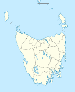
Location of the Kent Group in Bass Strait
|
|
| Etymology | William Kent |
|---|---|
| Geography | |
| Location | Bass Strait |
| Coordinates | 39°27′36″S 147°19′48″E / 39.46000°S 147.33000°E |
| Total islands | 6 |
| Major islands | Deal Island |
| Area | 1,576 ha (3,890 acres) |
| Administration | |
| State | Tasmania |
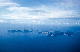
The Kent Group is a cluster of six beautiful granite islands. You can find them in Bass Strait, a sea channel between mainland Australia and Tasmania. They are located north-west of another island group called the Furneaux Group. All these islands together form the Kent Group National Park, a special protected area.
The islands were named by Matthew Flinders on February 8, 1798. He named them "Kent's Group" to honor his friend, Captain William Kent. At that time, Captain Kent was in charge of the ship Supply. Flinders sailed past these islands in his ship Francis.
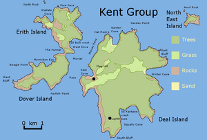
The largest island in the group is Deal Island. The other islands, from biggest to smallest, are Erith Island, Dover Island, North East Isle, South West Isle, and Judgement Rocks.
History of the Kent Group
People have visited the Kent Group islands for a long time. For example, seal hunting took place on these islands starting from at least 1803. This shows that the islands have been part of human activities for over 200 years.
Shipwrecks and Dangerous Waters
The area around the Kent Group, especially a channel called Murray Pass, has been a tricky spot for ships. Murray Pass is located between Deal Island and Erith Island. Sailors often used it to find shelter from strong winds and storms in Bass Strait. However, it's a partly open area, and sudden changes in wind direction and speed could make it very dangerous.
Many ships have been wrecked here. Some hit the islands while trying to find shelter. Others crashed due to poor navigation, especially at night or in bad weather. Sadly, some of these accidents led to many lives being lost.
Here are some of the ships that were wrecked near the Kent Group:
- 1816: Brothers, a schooner. One person was lost.
- 1819: Daphne, a brig. No lives were lost.
- 1819: John Palmer, a schooner. Two lives were lost.
- 1831: Ionia, a snow (a type of brig). Possibly three lives were lost.
- 1850: Ida, a schooner. No lives were lost.
- 1851: White Squall, a schooner. No lives were lost.
- 1852: Dorset, a brig. No lives were lost.
- 1852: Mary, a brig. No lives were lost.
- 1855: Elizabeth Mason, a schooner. No lives were lost.
- 1856: Kendall, a schooner. No lives were lost.
- 1862: Reindeer, a schooner. All hands, about 8 people, were lost.
- 1863: General Jessup, a barque. No lives were lost.
- 1866: Boscarne, a schooner. No lives were lost.
- 1875: Essie Black, a barque. All hands, about 10 people, were lost.
- 1877: Bulli, an iron steamship. No lives were lost. This wreck is popular for divers today.
- 1921: Karitane, a steel steamship. No lives were lost.
- 1930: Ida N, a new fishing boat. No lives were lost.
- 1961: St Nicholas, a newly finished fish carrier. No lives were lost.
 | Selma Burke |
 | Pauline Powell Burns |
 | Frederick J. Brown |
 | Robert Blackburn |


