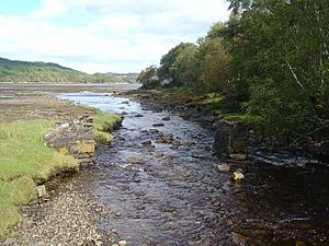
Kentra Bay facts for kids
Quick facts for kids Kentra Bay |
|
|---|---|
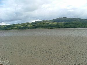
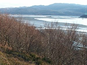
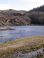
South across the mud of Kentra Bay. If it weren't for the small islands, this square would be mud and sand. Kentra Bay has an amazing tidal reach, and the tide seems to race in across the flats.
|
|
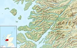
| Location | Northeast end of the Ardnamurchan peninsula near Acharacle, Scottish Highlands |
| Coordinates | 56°44′57.844″N 5°51′40.439″W / 56.74940111°N 5.86123306°W |
| River sources | Dig Bhàn Alt Eas an Taileir |
| Ocean/sea sources | Atlantic Ocean |
| Basin countries | Scotland |
| Max. length | 2.92 km (1.81 mi) |
| Max. width | 2.09 km (1.30 mi) |
| Islands | Eileanan nan Gad |
| Settlements | Kentra Ardtoe |
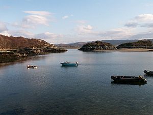
Kentra Bay, also known as the Singing Sands, is a beautiful bay in the Scottish Highlands of Scotland. It's found on the northern side of the Ardnamurchan peninsula, close to a village called Acharacle.
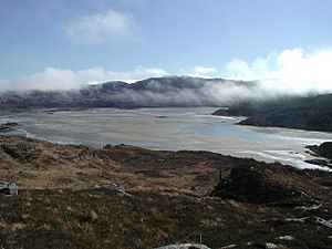
This bay is a "tidal" area, which means the water level changes a lot with the tides. When the tide is low, you can see large areas of mudflats. You might also spot small parts of salt marsh (grassy areas flooded by the sea), sand dunes, and machair (a special type of grassy plain found in Scotland). Kentra Bay is an inland bay, connected to the sea by a narrow channel.
Contents
Villages and Towns Around Kentra Bay
Several small places are located near Kentra Bay.
Ardtoe and Kentra
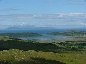
At the northern end of the channel that links the bay to the sea is the small village of Ardtoe. It has lovely sandy beaches where you can see views of the island of Eigg. A little further east is the village of Kentra, which gives the bay its name.
Acharacle and Arivegaig
Just a short distance east of Kentra is the larger village of Acharacle. To the south of Kentra, on the southeast side of Kentra Bay, is the tiny former farming settlement of Arivegaig.
Exploring the Geography of Kentra Bay
Kentra Bay has an interesting shape and is located inland, away from the open sea. It connects to the sea through a narrow channel.
The Channel and Surrounding Areas
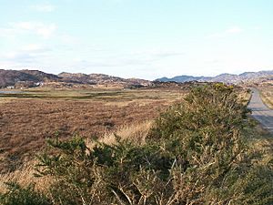
This channel is about 170 metres wide at the sea. It then widens to about 500 metres where it meets the main bay, about 1.4 kilometres from the sea. To the east of the bay is Kentra Moss. This area has several raised bogs (wetlands) in the low-lying coastal flats between Kentra Bay and the River Shiel. Some parts of Kentra Moss have been affected by drainage and peat cutting.
Western Peninsula and Rivers
To the west of the bay is a small peninsula, about 1.61 kilometres long. Kentra Bay is on its east side, and a sea loch called Loch Ceann Traigh is on its west side. This small peninsula is covered in thick forests and has a few small hills. The highest of these is (Scottish Gaelic: Creag an Fhradhairc), which is 88 metres high.
The southern coast of the bay has a mix of bogs and rocky areas. Three small rivers flow into the bay from this side. These are the (Scottish Gaelic: Allt a' Ghoirtein eòrna), the (Scottish Gaelic: Allt Eas an Failer), and the larger (Scottish Gaelic: Allt Beithe). On the eastern shore of the bay, you'll find another small river called (Scottish Gaelic: Dig Bhàn).
Islands of Kentra Bay
Kentra Bay is home to two groups of small islands.
Southern Islands
Close to the southern coast is a small group of two islands called (Scottish Gaelic: Eileanan Gad). These islands are easy to reach when the tide is low.
Northern Islands
Further north, near the east coast and slightly north of the village of Kentra, lies another group of tiny islands called (Scottish Gaelic: Eileanan Loisgte). These can also be reached when the tide is low. Even further north, in the channel that connects the bay to the sea loch, there are two very small, unnamed islands.
Amazing Plants of Kentra Bay
Kentra Bay is special because it has one of the largest salt marshes in the Scottish Highlands. This makes it a great place for different kinds of plants to grow.
Salt Marsh Plants
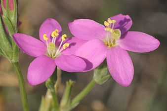
In the muddy areas of the bay, you can find glassworts. These are plants that can grow in salty soil. You'll also often see submerged eelgrass growing underwater. Sheep grazing in the area helps create perfect conditions for a rare pink-flowered plant called seaside centaury.
Bog Plants
The bog areas around Kentra Bay are very interesting for people who study plants. The mild weather here allows species to grow that are usually found in warmer places, like the New Forest in southern England. These include plants like brown beak-sedge and bog-sedge.
Gallery


