Keystone Lake facts for kids
Quick facts for kids Keystone Lake |
|
|---|---|
 |
|
| Location | Pawnee / Osage / Creek / Tulsa counties, Oklahoma, United States |
| Coordinates | 36°13′50″N 96°18′18″W / 36.2306°N 96.3050°W |
| Primary inflows | Arkansas River |
| Primary outflows | Arkansas River |
| Surface area | 23,600 acres (9,600 ha) |
| Average depth | 24 feet (7.3 m) (average) |
| Max. depth | 73 feet (22 m) |
| Water volume | 505,381 acre-feet (623,378,000 m3) (normal) |
| Shore length1 | 330 miles (530 km) |
| Surface elevation | 723 feet (220 m) (normal), 706 feet (215 m) (min.), 754 feet (230 m) (max.) |
| Settlements | Mannford, Sand Springs and Tulsa, Oklahoma |
| 1 Shore length is not a well-defined measure. | |
| Keystone Dam & Reservoir | |
|---|---|
| Country | United States |
| Location | Oklahoma Pawnee / Osage / Creek / Tulsa counties, Oklahoma |
| Purpose | Flood control, hydroelectric power generation, wildlife management and recreation |
| Status | Operational |
| Construction began | 1957 |
| Opening date | 1968 |
| Dam and spillways | |
| Impounds | Arkansas River |
| Length | 4,600 feet |
| Elevation at crest | 766 feet (max) |
| Spillways | 1 |
| Spillway type | Gated ogee weir |
| Spillway capacity | 939,000 cfs max. |
| Reservoir | |
| Surface area | 23,600 sq. ft. |
| Power station | |
| Turbines | Hydraulic (2) |
| Installed capacity | 35,000 KW each |
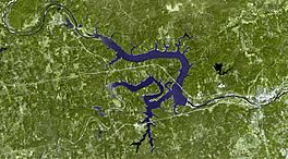
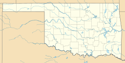
Keystone Lake is a large reservoir in northeastern Oklahoma. It was formed by the Keystone Dam on the Arkansas and Cimarron rivers. The lake is located about 23 miles (37 km) upstream from Tulsa.
The lake was created in 1968 when the Keystone Dam was finished. Its main purposes are to control floods, generate hydroelectric power (electricity from water), manage wildlife, and offer fun recreational activities.
Contents
About Keystone Lake
Keystone Lake covers about 23,600 acres (95.5 km²) of water. It was designed to hold a lot of water, about 505,381 acre-feet (623.4 million m³). The lake was named after the community of Keystone. This town existed from 1900 until 1962, when the area was flooded to create the lake.
Building the lake meant that three other towns had to be moved. These were Mannford, Oklahoma (also called New Mannford), Prue (also known as New Prue), and Appalachia Bay, Oklahoma. Part of the town of Osage was also affected. Engineers built a protective wall (levee) around low areas of Cleveland, Oklahoma to keep the city from flooding. The shoreline of the lake stretches for 330 miles (530 km).
Parks and Recreation at the Lake
Two Oklahoma state parks are located along the shores of Keystone Lake. These are Keystone State Park and Walnut Creek State Park. Both parks offer many activities like camping, hiking, biking, fishing, swimming, and boating. There is also a Yogi Bear's Jellystone Park Camp-Resort near the Keystone Dam.
Building the Keystone Dam
The Keystone Lake project was approved by the Flood Control Act of 1950. The Tulsa District of the Army Corps of Engineers designed and built it. Construction started in January 1957. The dam was ready to help control floods by September 1964. The power plant began making electricity in May 1968.
A smaller dam, called a reregulating dam, was also built downstream in 1968. This dam was later removed in 1986. The total cost for the entire project was about $123 million.
How the Dam Was Built
The Keystone Dam was built across the Arkansas River, just after it joins the Cimarron River. It is made mostly of packed earth. The dam stands 121 feet (37 m) tall above the riverbed. The total length of the dam is 4,600 feet (1,400 m). This includes a 1,600-foot (490 m) long concrete section.
Dam Features
The concrete section has a spillway that is 856 feet (261 m) wide. A spillway is like a giant drain that lets excess water out of the lake safely. State Highway 151 crosses the dam, connecting State Highway 51 on the south side with U.S. Highway 64 on the north.
The spillway has 18 large gates, each 40 by 35 feet (12 by 11 m). These gates can open to release a lot of water, up to 939,000 cubic feet per second (26,600 m³/s) at the highest water level. There are also nine smaller openings called sluices.
Generating Electricity
The dam also has a power intake structure. This part of the dam takes water into two large pipes, each 27 feet (8.2 m) wide. These pipes lead to two hydroelectric generators. Each generator can produce 35,000 kilowatts (kW) of electricity. This means the dam can make a lot of clean energy!
Big Water Release in 1986
In September and October 1986, Keystone Lake became very full. This happened because the remains of Hurricane Paine brought nearly 22 inches (0.56 m) of rain to the area. This huge amount of rain flowed into the Cimarron and Arkansas rivers, filling the lake.
Because the lake was so full, the Corps of Engineers had to release water downstream very quickly. They released water at a rate of 310,000 cubic feet per second (8,800 m³/s). This large release caused some areas downstream to experience flooding.
Fun Activities at Keystone Lake
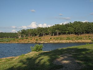
Keystone Lake is a popular spot for outdoor fun! The Corps of Engineers website lists 16 recreational areas around the lake. These include three beaches where alcohol is not allowed, 11 boat ramps, and four marinas. There are also two areas for off-road vehicles.
You can find campgrounds, a special area for waterfowl (like ducks and geese), and a public hunting area. Keystone State Park also offers cabins for rent.
Fishing and Wildlife
Fishing is very popular at Keystone Lake. Some of the most common fish you can catch include:
- Striped bass
- White bass
- Black bass
- Smallmouth bass
- Crappie
- Catfish
The area around the lake is home to many animals. You might see:
- White-tailed deer
- Raccoons
- Bobcats
- Coyotes
- Beavers
- Squirrels
- Cottontail rabbits
- Quail
- Dove
- Ducks
- Geese
Rules for hunting and fishing are set by Oklahoma and federal laws.
Sailing Fun
If you like sailing, the Windycrest Sailing Club offers sailboat racing and cruising on the lake. It's a great place for sailing enthusiasts!


