Kin Tiel facts for kids
Quick facts for kids |
|
|
Kin Tiel
|
|

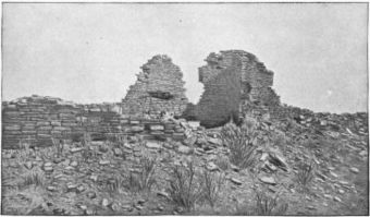
Kin Tiel standing walls
|
|
| Lua error in Module:Location_map at line 420: attempt to index field 'wikibase' (a nil value). | |
| Location | Chambers, Arizona |
|---|---|
| Area | 30 acres (12 ha) |
| NRHP reference No. | 78000540 |
| Added to NRHP | May 22, 1978 |
Kin Tiel, also known as the Wide Ruins, is an important historical site in Arizona. It's a very old and large pueblo, which is a type of village built by ancient Native American people. This site has been explored and dug up by archaeologists many times to learn about its past. Kin Tiel was added to the National Register of Historic Places on May 22, 1978, meaning it's a special place worth protecting. It is located about 50 miles north of Chambers, Arizona, in Apache County.
Contents
Discovering Kin Tiel's Past
How Kin Tiel Was Built
The Kin Tiel pueblo was built in the year 1276 AD. It was constructed all at once, which is amazing for such a large place! This ancient village had over 1300 rooms and was three stories tall. Imagine living in a building that big so long ago!
Early Explorers and Finds
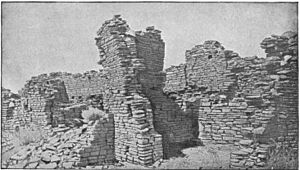
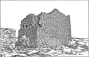
In the 1880s, a person named Victor Mindeleff visited the ruins. At that time, much of the outer wall was still standing, reaching two stories high. Archaeologists have found special pottery at the site. This pottery is now known as the "Kin Tiel focus" of the "Rio Puerco" pattern. The National Geographic Society also explored the site in 1929.
What Happened to the Stones?
Sadly, many of the stones that were still standing in the walls were taken down around 1895. They were used to build a trading post nearby. That trading post was later torn down in the 1980s.
Modern Day Exploration
Today, there's an exciting excavation project happening at Kin Tiel. It's a joint effort by the Historic American Buildings Survey (HABS) and Historic American Engineering Record (HAER). They are using cool modern technologies to study the ancient artifacts. These tools include 3-D laser scanning, ground penetrating radar, and magnetometers. These help them find and record things hidden underground without digging them up right away.
Exploring the Pueblo's Layout
Where is Kin Tiel Located?
The Kin Tiel pueblo is found between two other ancient pueblos, Tusayan and Cibola. It's about 23 miles north of Navajo Springs and about 17 miles north of Chambers.
The Pueblo's Walls and Rooms
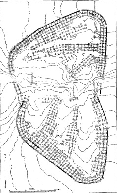
This pueblo had a strong outer wall that went all the way around it. This wall was three stories tall! It had only a few small openings near the ground. Inside the wall, there were terraces that faced enclosed courtyards.
How the Pueblo Was Designed
The pueblo has two parts, or "wings," that are almost the same size. These wings are on either side of a central dry streambed, called a wash, which runs from east to west. The houses in the northern part of the pueblo are mostly built parallel to the outer wall. However, the houses in the southern part are built at right angles to the wall. This was because of the land's shape: the southern rooms are on two long ridges, while the northern ones are on high ground along the wall.
Entrances and Other Features
There were only three known entrances into the pueblo's inside. One was just south of the east end of the wash, another near the northeastern corner, and the third in the north wall. The people lived here for a very long time, which we know because of a large pile of ancient trash, called a refuse heap, to the south. The pueblo was self-contained, meaning there were no big buildings outside its main wall. To the north, there are rectangular shapes that suggest a graveyard. Kin Tiel was built in the Chacoan style, covering about 30 acres. This makes it one of the largest pueblo sites in the southwestern United States!


