Kingsford Heights, Indiana facts for kids
Quick facts for kids
Town of Kingsford Heights, Indiana
|
|
|---|---|

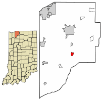
Location of Kingsford Heights in LaPorte County, Indiana.
|
|
| Country | United States |
| State | Indiana |
| County | LaPorte |
| Township | Union |
| Area | |
| • Total | 0.89 sq mi (2.30 km2) |
| • Land | 0.89 sq mi (2.30 km2) |
| • Water | 0.00 sq mi (0.00 km2) |
| Elevation | 722 ft (220 m) |
| Population
(2020)
|
|
| • Total | 1,335 |
| • Density | 1,503.38/sq mi (580.26/km2) |
| Time zone | UTC-6 (CST) |
| • Summer (DST) | UTC-5 (CDT) |
| ZIP code |
46346
|
| Area code(s) | 219 |
| FIPS code | 18-39852 |
| GNIS feature ID | 2396692 |
Kingsford Heights is a small town in LaPorte County, Indiana, United States. It is part of the Michigan City, Indiana-La Porte, Indiana area. In 2020, about 1,335 people lived there. This town was built by the U.S. government for people who worked at the Kingsbury Ordnance Plant. This plant made ammunition for the U.S. during World War II and the Korean War. Kingsford Heights was also known as "Victory City."
Contents
History of Kingsford Heights
During World War I, factories on the U.S. east coast that made ammunition faced many problems. Because of this, military leaders decided to build new factories inland. This would make them safer and help them produce more.
In 1940, the Kingsbury Ordnance Plant was built in Indiana. It was a very important factory. About 10,000 workers and their families were expected to move there. However, LaPorte County only had 16,000 people in total back then.
So, the government decided to build a whole new town near the plant. It was first called Victory City. In 1942, its name changed to Kingsford Heights.
The original plan for Kingsford Heights was to have 3,000 homes. It would also have businesses, schools, a community center, and a park. But after World War II and the Korean War ended, the ammunition plant closed. Many workers moved away to find new jobs.
Because of this, the town's development stopped. The people who stayed bought the land from the government. They officially made it a town to keep local services going. They also decided to rename it Kingsford Heights.
Geography of Kingsford Heights
Kingsford Heights is located in Indiana. According to the 2010 census, the town covers about 0.94 square miles (2.43 square kilometers). All of this area is land.
Population Information
| Historical population | |||
|---|---|---|---|
| Census | Pop. | %± | |
| 1950 | 1,104 | — | |
| 1960 | 1,276 | 15.6% | |
| 1970 | 1,200 | −6.0% | |
| 1980 | 1,618 | 34.8% | |
| 1990 | 1,486 | −8.2% | |
| 2000 | 1,453 | −2.2% | |
| 2010 | 1,435 | −1.2% | |
| 2020 | 1,335 | −7.0% | |
| Source: US Census Bureau | |||
Kingsford Heights in 2010
In 2010, there were 1,435 people living in Kingsford Heights. There were 509 households and 374 families. The town had about 1,527 people per square mile (589 people per square kilometer).
About 42% of households had children under 18 living with them. About 45% were married couples. The average household had 2.82 people.
The average age in town was 33 years old. About 30% of residents were under 18. About 11% were 65 or older.
Education in Kingsford Heights
Kingsford Heights has an elementary school called Kingsford Heights Elementary School. It is part of the LaPorte Community School Corporation.
Families in Kingsford Heights can choose from three different school districts:
- LaPorte Community School Corporation
- Oregon-Davis Community School Corporation
- South Central Community Schools
The town also has a public library. It is a branch of the LaPorte County Public Library.
See also
In Spanish: Kingsford Heights (Indiana) para niños
 | Kyle Baker |
 | Joseph Yoakum |
 | Laura Wheeler Waring |
 | Henry Ossawa Tanner |

