Kipps Run facts for kids
Quick facts for kids Kipps Run |
|
|---|---|

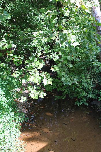
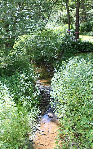
Kipps Run looking downstream
|
|
| Other name(s) | Kipp's Run |
| Physical characteristics | |
| Main source | Rush Township, Northumberland County, Pennsylvania near Blue Hill |
| River mouth | Susquehanna River at Riverside, Pennsylvania 443 ft (135 m) 40°57′00″N 76°39′46″W / 40.9499°N 76.6628°W |
| Length | 3.3 mi (5.3 km) |
| Basin features | |
| Basin size | 6.38 sq mi (16.5 km2) |
| Tributaries |
|
Kipps Run (also called Kipp's Run) is a small stream in Northumberland County, Pennsylvania, United States. It flows into the Susquehanna River. The stream is about 3.3 miles (5.3 km) long. It runs through Rush Township and the town of Riverside.
Kipps Run has a smaller stream called Wilson Run that flows into it. The area of land that drains into Kipps Run, called its watershed, is about 6.38 square miles (16.5 km2). Most of this land is farms or forests. The stream also has a special area of plants along its banks called a riparian buffer, which helps keep the water clean.
Contents
Where Kipps Run Flows
Kipps Run starts in the northern part of Rush Township. Its very beginning, called its headwaters, is on a place called Blue Hill.
The stream first flows southwest, then turns northwest through a valley. After a short distance, it turns north and follows a road. It then leaves Rush Township and enters the town of Riverside. Here, it turns west-northwest, moving away from the road and leaving its valley.
Kipps Run then meets its only named smaller stream, Wilson Run, which flows in from the left side. After this, Kipps Run goes through a few small ponds. Further along, it turns northwest again, crosses another road, and then goes under the Delaware and Hudson Railroad tracks. Right after that, Kipps Run flows into the large Susquehanna River.
Kipps Run joins the Susquehanna River about 134.14 miles (215.88 km) from where the Susquehanna River itself ends.
Wilson Run: A Branch of Kipps Run
The only named stream that flows into Kipps Run is Wilson Run. Wilson Run joins Kipps Run about 1.54 miles (2.48 km) before Kipps Run reaches the Susquehanna River. The land area that drains into Wilson Run is about 3.27 square miles (8.5 km2).
Stream Health and Sediment
Every year, a lot of sediment (like dirt and tiny rocks) is carried by the water in Kipps Run. About 4,985,600 pounds (2,261,400 kg) of sediment moves through the stream each year.
Most of this sediment comes from farm fields, contributing about 4,565,200 pounds (2,070,700 kg). The banks of the stream itself add about 195,600 pounds (88,700 kg) of sediment. Hay fields and pastures add another 143,600 pounds (65,100 kg). Forests contribute a smaller amount, around 47,400 pounds (21,500 kg) per year.
Land Around Kipps Run
The land around Kipps Run has different features. To the east, there's a bowl-shaped area where the town of Riverside is located. To the west and south of Sunbury Road, the land rises steeply, reaching over 900 feet (270 m) above sea level. To the west and north of Sunbury Road, the land is mostly flat. Near where it joins the Susquehanna River, Kipps Run is about 443 feet (135 m) above sea level.
The average amount of rain and snow (precipitation) in the Kipps Run area is about 38.2 inches (97 cm) each year.
Kipps Run Watershed
The total area of land that drains into Kipps Run, known as its watershed, is 6.38 square miles (16.5 km2).
- About 48 percent of this land is used for farming.
- Another 48 percent is covered by forests.
- The remaining 4 percent is used for other things, like small towns or areas that are changing.
In the western part of the watershed, south of Sunbury Road, there are mostly forests with some farms on top of the hills. North of Sunbury Road and west of the stream, there are large areas of farmland.
Kipps Run is considered one of the most important streams in the town of Riverside.
History of Kipps Run Area
People have lived and worked near Kipps Run for a long time.
- In 1790, a person named William Gearhart settled near Kipps Run in Northumberland County.
- Later, in 1854, Alem Marr Sechler bought a farm along the stream.
- In the late 1800s, the Danville, Hazleton and Wilkes-Barre Railroad had tracks that passed by Kipps Run.
During a big flood in 1904, a deep valley in the Kipps Run area actually helped stop the floodwaters from reaching areas further downstream for several days.
There's also a place called the Kipp's Run Swim Club, which has been in the area south of Kipps Run since at least 1962. In the late 1960s, the town of Riverside planned to build a pumping station near the stream.
In July 2012, Kipps Run was chosen as a special "reference watershed" for a plan to improve water quality in another stream called Deerlick Run.
Plants and Animals
Kipps Run has a good riparian buffer. This is a strip of trees and plants along the banks of the stream. These plants help keep the stream healthy by filtering out pollution and providing homes for wildlife.
 | Shirley Ann Jackson |
 | Garett Morgan |
 | J. Ernest Wilkins Jr. |
 | Elijah McCoy |


