Wilson Run (Kipps Run tributary) facts for kids
Quick facts for kids Wilson Run |
|
|---|---|

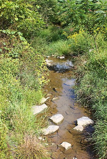
Wilson Run looking downstream
|
|
| Other name(s) | Wilsons Run, Wilson's Run |
| Physical characteristics | |
| Main source | hill in Rush Township, Northumberland County, Pennsylvania 920 ft (280 m) |
| River mouth | Kipps Run in Riverside, Northumberland County, Pennsylvania 528 ft (161 m) 40°56′26″N 76°38′30″W / 40.94059°N 76.64154°W |
| Length | 3.6 mi (5.8 km) |
| Basin features | |
| Progression | Kipps Run → Susquehanna River → Chesapeake Bay |
| Basin size | 3.27 sq mi (8.5 km2) |
Wilson Run (also called Wilsons Run or Wilson's Run) is a small stream in Northumberland County, Pennsylvania. It flows into Kipps Run. The stream is about 3.6 miles (5.8 km) long. It runs through Rush Township and Riverside.
The area of land that drains into Wilson Run is about 3.27 square miles (8.5 km2). This stream is important for fish. It is known as a Coldwater Fishery and a Migratory Fishery. This means it's a good place for fish that like cold water and for fish that travel to lay eggs. Many bridges cross Wilson Run, and a mill used to operate there long ago.
Contents
The Stream's Path
Wilson Run starts on a hill in Rush Township. It flows towards the northwest for a short distance. Then, it enters a shallow valley and turns north.
After a while, it turns northeast and crosses a road called State Route 4004. The stream then flows north-northwest for over a mile. During this part of its journey, it runs next to Pine Swamp Road. The valley around the stream gets deeper as it flows.
Eventually, Wilson Run enters the town of Riverside. After flowing a short distance in Riverside, it turns northeast. Soon after, it meets and joins Kipps Run. Wilson Run flows into Kipps Run about 1.54 miles (2.48 km) before Kipps Run reaches its own end.
Land Around the Stream
The land near where Wilson Run joins Kipps Run is about 528 feet (161 m) above sea level. The stream begins at a higher point, a little less than 920 feet (280 m) above sea level.
Years ago, the flow of Wilson Run was blocked. Things like fallen trees, logs, and rocks got in the way. This caused the banks of the stream to wear away, which is called erosion. However, by 1980, the stream's path was fixed and cleared. Rocks called sandstone can be found near Wilson Run.
The Stream's Watershed
The watershed of Wilson Run is the entire area of land where water flows into this stream. This area covers about 3.27 square miles (8.5 km2). Wilson Run is located in the Riverside area, according to the United States Geological Survey. It is one of the main streams in Rush Township.
History of Wilson Run
A mill used to be located on Wilson Run a long time ago. A person named Vastine owned this mill. Mills like this used the power of the flowing water to grind grain.
Wilson Run was officially added to the Geographic Names Information System on August 2, 1979. This system keeps track of names and locations of places in the United States.
Several bridges have been built over Wilson Run to help people cross it.
- A concrete bridge was built in 1957. It is about 26.9 feet (8.2 m) long.
- Another bridge was built in Riverside in 1961. It was fixed in 2012 and is about 32.2 feet (9.8 m) long.
- A third bridge, made of concrete, was built in Riverside in 1986. This bridge is about 23.0 feet (7.0 m) long.
A bridge that carries Kipps Run Road over Wilson Run was also replaced in the past. This project cost about $60,000 and was planned in 2012.
Animals and Plants
Wilson Run is an important place for fish. It is known as a Coldwater Fishery. This means it has cold water, which is good for certain types of fish. It is also a Migratory Fishery. This means fish travel through it to other places, often to lay their eggs. Scientists have found a fossil of a shell from a creature called M. mytiloides in the sandstone near the stream.
 | James Van Der Zee |
 | Alma Thomas |
 | Ellis Wilson |
 | Margaret Taylor-Burroughs |


