Klickitat River facts for kids
Quick facts for kids Klickitat River |
|
|---|---|

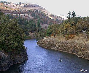
The Klickitat River outside Lyle, Washington
|
|
|
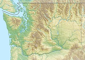
Mouth of the Klickitat River in Washington
|
|
| Country | United States |
| State | Washington |
| County | Klickitat County, Yakima County |
| Physical characteristics | |
| Main source | Cascade Range, Yakima County, Washington 6,440 ft (1,960 m) 46°29′13″N 121°25′16″W / 46.48694°N 121.42111°W |
| River mouth | Columbia River Lyle, Washington 80 ft (24 m) 45°41′47″N 121°17′29″W / 45.69639°N 121.29139°W |
| Length | 95.8 mi (154.2 km) |
| Basin features | |
| Basin size | 1,350 sq mi (3,500 km2) |
| Type: | Recreational |
| Designated: | November 17, 1986 |
The Klickitat River is a river in south-central Washington, United States. It flows into the Columbia River and is about 96 miles (154 km) long. The river helps drain a high, flat area called a plateau on the eastern side of the Cascade Range. This area is northeast of Portland, Oregon.
In 1986, a special part of the Klickitat River was named a "Wild and Scenic River." This means 10 miles (16 km) of the river are protected. This protected section runs from where Wheeler Creek joins the Klickitat, near a town called Pitt, all the way to where the Klickitat meets the Columbia River.
River's Journey
The Klickitat River starts high up in the Cascade Range mountains. Its source is near Gilbert Peak in the northwestern part of Yakima County. This area is a remote part of the Yakama Indian Reservation.
From there, the river flows mostly south. It crosses a flat area known as the Lincoln Plateau. Then, it enters northern Klickitat County. The river then winds and turns through deep, narrow valleys called canyons.
Finally, the Klickitat River joins the Columbia River from the north. This meeting point is at Lyle, which is about 10 miles (16 km) north-northwest of The Dalles, Oregon. A road called State Route 142 follows the lower 15 miles (24 km) of the river. Another road, State Route 14, crosses the river right where it meets the Columbia.
Fun on the River
The Klickitat Trail is a popular path that follows the river. It was built on an old railroad track. This trail stretches for almost 30 miles (48 km). You can find it starting near Goldendale, Washington, and it goes all the way to the Columbia River, just west of The Dalles, Oregon. It's a great place for hiking and enjoying nature.
 | Aurelia Browder |
 | Nannie Helen Burroughs |
 | Michelle Alexander |


