Koloa, Hawaii facts for kids
Quick facts for kids
Kōloa, Hawaii
|
|
|---|---|

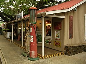
A shop in Kōloa
|
|

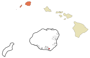
Location in Kauai County and the state of Hawaii
|
|
| Country | United States |
| State | Hawaii |
| County | Kauai |
| Area | |
| • Total | 1.25 sq mi (3.24 km2) |
| • Land | 1.25 sq mi (3.24 km2) |
| • Water | 0.00 sq mi (0.00 km2) |
| Elevation | 213 ft (65 m) |
| Population
(2020)
|
|
| • Total | 2,231 |
| • Density | 1,781.95/sq mi (688.26/km2) |
| Time zone | UTC-10 (Hawaii-Aleutian) |
| ZIP code |
96756
|
| Area code(s) | 808 |
| FIPS code | 15-39200 |
| GNIS feature ID | 0361395 |
Kōloa is a community in Kauaʻi County, Hawaiʻi, United States. It is known as a census-designated place (CDP). This means it's a special area defined by the government for counting people.
In 2020, about 2,231 people lived in Kōloa. This was more than the 1,942 people who lived there in 2000. Kōloa is famous for being the place where the first successful sugarcane plantation in the Hawaiian Islands began in 1835. Later, in 1948, it became part of a larger farm called Grove Farm.
The name Kōloa means "a long cane with a crook." There's also a similar word, koloa (without the macron mark), which means "native duck." Some people say the Kōloa district got its name from a tall rock called Pali-o-kō-loa, found in Waikomo Stream.
Contents
Geography of Kōloa
Kōloa is located on the southern part of the island of Kauai. You can find it at these coordinates: 21°54′26″N 159°27′57″W / 21.90722°N 159.46583°W. It shares borders with Omao to the northwest and Poipu to the south.
The community covers an area of about 3.2 square kilometers (1.25 square miles). All of this area is land. A stream called Waikomo Stream flows right through the middle of Kōloa.
People of Kōloa
| Historical population | |||
|---|---|---|---|
| Census | Pop. | %± | |
| 2020 | 2,231 | — | |
| U.S. Decennial Census | |||
In 2000, there were 1,942 people living in Kōloa. These people lived in 693 homes, and 507 of these were families. The population density was about 1,629 people per square mile.
About 35% of the homes had children under 18 living there. Nearly half of the homes (47%) were married couples. About 23% of all homes had people living alone. The average home had 2.80 people, and the average family had 3.25 people.
The population was spread out by age. About 26% were under 18 years old. About 16% were 65 years or older. The average age in Kōloa was 36 years old.
History of Kōloa
The Old Sugar Mill of Koloa started in 1835. It was the first big sugarcane plantation in Hawaiʻi. This was a very important step for the economy of the islands.
In 1855, a missionary named Daniel Dole and his family opened a school in Kōloa. This school was for children who spoke English. It was sometimes called the Koloa Academy.
Places to Visit in Kōloa
There are many interesting places to see in and around Kōloa:
- Old Sugar Mill – This is a National Historic Landmark. It was the first successful large-scale sugar plantation in Hawaiʻi, started in 1835.
- Poipu Bay Golf Course – This golf course hosted a big golf tournament, the PGA Grand Slam of Golf, from 1994 to 2006.
- Saint Raphael Catholic Church – This is the oldest Catholic church on Kauaʻi.
- Spouting Horn – A park where you can see a natural blowhole. Water shoots high into the air!
- Hoʻai heiau – An ancient Hawaiian temple site.
- Kāneiolouma Complex – An archaeological site that shows where an ancient Hawaiian village used to be.
- Makauwahi Cave – A large limestone cave with fossils and ancient plant remains.
Famous People from Kōloa
- Raymond Kāne – A famous slack-key guitarist. Slack-key guitar is a special Hawaiian style of playing.
- Prince Jonah Kuhio Kalanianaʻole Piʻikoi – He was born in Kōloa. He was an heir to the throne of Hawaiʻi. He also served as a minister for the Kingdom of Hawaiʻi and later became a representative in the U.S. Congress in 1903.
See also
 In Spanish: Koloa para niños
 | Jessica Watkins |
 | Robert Henry Lawrence Jr. |
 | Mae Jemison |
 | Sian Proctor |
 | Guion Bluford |


