Kolyma (river) facts for kids
Quick facts for kids Kolyma |
|
|---|---|
 |
|
|
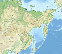
Location of the river mouth in the Far Eastern Federal District, Russia
|
|
| Country | Russia |
| Physical characteristics | |
| Main source | Confluence of the Ayan-Yuryakh and the Kulu 62°17′40″N 147°43′55″E / 62.29444°N 147.73194°E |
| River mouth | East Siberian Sea 69°32′52″N 161°21′51″E / 69.5477°N 161.3641°E |
| Length | 2,129 km (1,323 mi) |
| Discharge (location 2) |
|
| Basin features | |
| Basin size | 647,000 km2 (250,000 sq mi) |
| Tributaries |
|
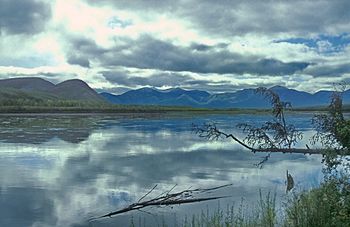
The Kolyma (Russian: Колыма) is a very long river in northeastern Siberia, a cold region in Russia. Its huge river basin covers parts of the Sakha Republic, Chukotka Autonomous Okrug, and Magadan Oblast.
Because it's so cold, the Kolyma River is frozen solid for about 250 days each year. That's more than two-thirds of the year! It usually becomes free of ice only in early June and stays that way until October.
Contents
Where the Kolyma River Flows
The Kolyma River starts where two smaller rivers, the Kulu and the Ayan-Yuryakh, meet. This happens in the Khalkan Range mountains. At first, the Kolyma flows through high areas called the Upper Kolyma Highlands.
After leaving the mountains, the river flows mostly north across a huge flat area called the Kolyma Lowland. This lowland is part of the larger East Siberian Lowland and has thousands of lakes. Finally, the Kolyma River empties into the Kolyma Gulf, which is part of the East Siberian Sea. This sea is connected to the Arctic Ocean.
The Kolyma River is about 2,129 kilometres (1,323 mi) long. That's like driving across a big country! The area of land that drains into the Kolyma River, called its basin, is about 647,000 square kilometres (250,000 sq mi).
Rivers Joining the Kolyma
Many smaller rivers and streams flow into the Kolyma. These are called tributaries. Here are some of the main ones, listed from where the Kolyma starts to where it ends:
- Ayan-Yuryakh (joins from the left)
- Kulu (joins from the right)
- Tenka (joins from the right)
- Buyunda (joins from the right)
- Bakhapcha (joins from the right)
- Seymchan (joins from the left)
- Balygychan (joins from the right)
- Sugoy (joins from the right)
- Korkodon (joins from the right)
- Bulun
- Popovka (joins from the left)
- Yasachnaya (joins from the left)
- Zyryanka (joins from the left)
- Debin (joins from the left)
- Taskan (joins from the left)
- Ozhogina (joins from the left)
- Sededema (joins from the left)
- Beryozovka (joins from the right)
- Omolon (joins from the right)
- Oloy
- Anyuy (joins from the right)
- Bolshoy Anyuy
- Maly Anyuy
Islands at the River Mouth
Near where the Kolyma River meets the East Siberian Sea, it splits into two big branches. There are many islands here. Some of the most important ones are:
- Mikhalkino is the biggest island. It's about 24 kilometres (15 mi) long and 6 kilometres (4 mi) wide.
- Sukharnyy is about 3 kilometers from Mikhalkino. It's 11 kilometres (7 mi) long and 5 kilometres (3 mi) wide.
- Piat' Pal'tsev is 5 kilometers southeast of Sukharnyy. It's 5 kilometers long.
- Nazarovsky Island is on the western side of the river's western branch. It's 4.5 kilometers long.
- Shtormovoy Island is about 10 kilometres (6 mi) north of Nazarovsky Island. It's the northernmost island near the Kolyma's mouth.
History of the Kolyma River Area
In the 1600s, Russian explorers began to reach the Kolyma River.
- In 1640, Dimitry Zyryan traveled to the Indigirka River. He then sailed east and heard about the Kolyma.
- In 1644, Mikhail Stadukhin reached the Kolyma and built a winter cabin, likely near where Srednekolymsk is today.
Later, in 1892–94, a scientist named Baron Eduard Von Toll explored the Kolyma basin. He traveled a huge distance, about 25,000 kilometres (16,000 mi), to study the geology of the area.
The Kolyma region became known for its gold mining. In the past, during the time of Joseph Stalin in the Soviet Union, there were also many labor camps in this area. Life in these camps was very difficult. A famous book called The Kolyma Tales by Varlam Shalamov tells stories about what it was like there.
After these camps closed, many people moved away because there wasn't much work. But some people stayed and now make a living by fishing and hunting. In small fishing villages, they sometimes store fish in caves carved out of permafrost, which is ground that is permanently frozen.
In 2012, scientists made an amazing discovery near the Kolyma River. They found 30,000-year-old fruit from a plant called Silene stenophylla that had been stored in squirrel burrows and preserved in the permafrost. They were able to grow new plants from these ancient fruits!
Towns and Settlements
Some of the towns and settlements along the Kolyma River include:
- Sinegorye
- Debin
- Ust-Srednekan
- Seymchan
- Zyryanka
- Srednekolymsk
- Chersky
Buildings and Structures
The Kolyma Hydroelectric Station is a large power plant located at Sinegorye. It uses the river's water to create electricity. This plant was started in the 1980s and provides most of the electricity for the region, including the city of Magadan. The dam is made of earth and is about 150 feet high. It's special because it was built in a permafrost region, where the ground is always frozen.
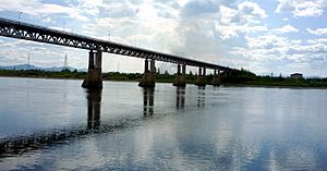
There are only a few bridges that cross the Kolyma River. You can find them at Ust-Srednekan, Sinegorye, and Debin. The bridge at Debin is part of the Kolyma Highway.
See also
 In Spanish: Río Kolimá para niños
- Kolyma (the larger region)
- East Siberian Mountains
- List of rivers of Russia
 | Tommie Smith |
 | Simone Manuel |
 | Shani Davis |
 | Simone Biles |
 | Alice Coachman |


