Korendijk facts for kids
Quick facts for kids
Korendijk
|
|||
|---|---|---|---|
|
Former municipality
|
|||

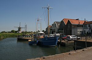
Harbour of Nieuw-Beijerland
|
|||
|
|||

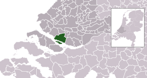
Location in South Holland
|
|||
| Country | Netherlands | ||
| Province | South Holland | ||
| Established | 1 January 1984 | ||
| Merged | 2019 | ||
| Area | |||
| • Total | 100.47 km2 (38.79 sq mi) | ||
| • Land | 77.26 km2 (29.83 sq mi) | ||
| • Water | 23.21 km2 (8.96 sq mi) | ||
| Elevation | 0 m (0 ft) | ||
| Population
(May 2014)
|
|||
| • Total | 10,716 | ||
| • Density | 139/km2 (360/sq mi) | ||
| Time zone | UTC+1 (CET) | ||
| • Summer (DST) | UTC+2 (CEST) | ||
| Postcode |
3264–3267, 3284
|
||
| Area code | 0186 | ||
Korendijk was a special area in the western Netherlands. It was like a small local government, called a municipality. It was located in the province of South Holland.
This municipality covered an area of about 100.47 km2 (38.79 sq mi). A part of this area, about 23.21 km2 (8.96 sq mi), was water.
Contents
The Story of Korendijk
How Korendijk Was Formed
The municipality of Korendijk was created on January 1, 1984. This happened during a big change in how areas were organized in the Hoeksche Waard.
Several smaller municipalities joined together to form Korendijk. These included Goudswaard, Nieuw-Beijerland, Piershil, and Zuid-Beijerland. The island of Tiengemeten also became part of Korendijk.
Piershil was an important village because it was where the town hall was located. Besides these main villages, Korendijk also included smaller places like Nieuwendijk and Zuidzijde.
When Korendijk Changed
Korendijk existed as a separate municipality for many years. However, on January 1, 2019, it merged with other areas.
It became part of a new, larger municipality called Hoeksche Waard. This means Korendijk is no longer a separate local government.
Where Korendijk Was Located
Korendijk was situated in a unique spot. On its southern side, it was next to the Haringvliet estuary. An estuary is where a river meets the sea.
To the west, it bordered the Spui River. To the north and east, Korendijk was next to other municipalities. These were Oud-Beijerland and Cromstrijen.
Understanding the Land: Topography
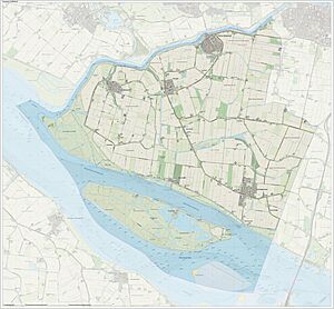
Topography is about the shape and features of the land. It shows things like rivers, towns, and how high or low the ground is.
This map helps us understand the landscape of the former Korendijk area. It shows how the land looked in 2015.
See also
 In Spanish: Korendijk para niños
 | William L. Dawson |
 | W. E. B. Du Bois |
 | Harry Belafonte |


