Cromstrijen facts for kids
Quick facts for kids
Cromstrijen
|
|||
|---|---|---|---|

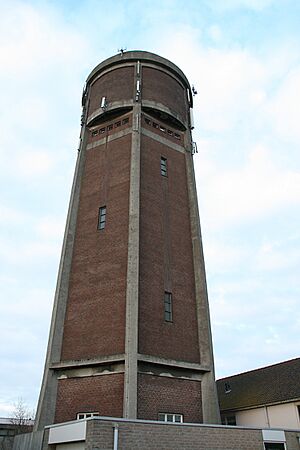
Water tower in Klaaswaal
|
|||
|
|||

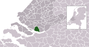
Location in South Holland
|
|||
| Country | Netherlands | ||
| Province | South Holland | ||
| Established | 1 January 1984 | ||
| Merged | 2019 | ||
| Area | |||
| • Total | 70.33 km2 (27.15 sq mi) | ||
| • Land | 54.37 km2 (20.99 sq mi) | ||
| • Water | 15.96 km2 (6.16 sq mi) | ||
| Elevation | 0 m (0 ft) | ||
| Population
(May 2014)
|
|||
| • Total | 12,797 | ||
| • Density | 235/km2 (610/sq mi) | ||
| Time zone | UTC+1 (CET) | ||
| • Summer (DST) | UTC+2 (CEST) | ||
| Postcode |
3280–3281, 3286
|
||
| Area code | 0186 | ||
Cromstrijen (pronounced like "krom-STRAY-en") was a special kind of local government area called a municipality. It was located on the Hoeksche Waard Island in the western part of the Netherlands. This area is part of the South Holland province.
The municipality of Cromstrijen covered about 70.33 km2 (27.15 sq mi) of land and water. A small part of this, about 15.96 km2 (6.16 sq mi), was water.
Cromstrijen was created on January 1, 1984. This happened when smaller municipalities on the Hoeksche Waard Island joined together. Later, on January 1, 2019, Cromstrijen itself joined with four other municipalities. These were Binnenmaas, Korendijk, Oud-Beijerland, and Strijen. Together, they formed a new, larger municipality called Hoeksche Waard.
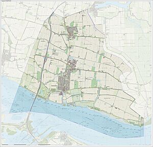
The main communities within Cromstrijen were Klaaswaal and Numansdorp. Numansdorp was where the town hall was located. In 2014, about 12,797 people lived in Cromstrijen.
Where Was Cromstrijen Located?
Cromstrijen was situated on the Hoeksche Waard island. This island is known for its beautiful landscapes and polders. Polders are low-lying lands that have been reclaimed from the sea.
The area was mostly flat, which is typical for much of the Netherlands. It was a place where people lived and worked, surrounded by nature.
What Is a Municipality?
A municipality is like a local government area. It's a bit like a county or a town in other countries. Municipalities in the Netherlands have their own local councils and mayors. They manage things like local roads, schools, and public services.
When municipalities merge, it means they combine to form one bigger area. This can happen to make local government more efficient. It also helps manage resources better across a larger region.
See also
 In Spanish: Cromstrijen para niños
 | Chris Smalls |
 | Fred Hampton |
 | Ralph Abernathy |


