Binnenmaas facts for kids
Quick facts for kids
Binnenmaas
|
|||
|---|---|---|---|
|
Former municipality
|
|||

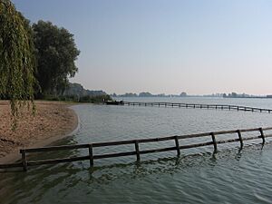
Lake Binnenmaas
|
|||
|
|||

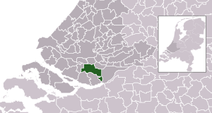
Location in South Holland
|
|||
| Country | Netherlands | ||
| Province | South Holland | ||
| Municipality | Hoeksche Waard | ||
| Merged | 2019 | ||
| Area | |||
| • Total | 75.57 km2 (29.18 sq mi) | ||
| • Land | 69.26 km2 (26.74 sq mi) | ||
| • Water | 6.31 km2 (2.44 sq mi) | ||
| Elevation | −1 m (−3.3 ft) | ||
| Population
(May 2014)
|
|||
| • Total | 28,670 | ||
| • Density | 414/km2 (1,070/sq mi) | ||
| Time zone | UTC+1 (CET) | ||
| • Summer (DST) | UTC+2 (CEST) | ||
| Postcode |
3270–3274, 3295–3299
|
||
| Area code | 0186, 078 | ||
Binnenmaas (pronounced like BIN-nen-mahs) was a special area in the western Netherlands. It was a type of local government area called a municipality. This means it was like a small town or district with its own local council.
Binnenmaas was located in the province of South Holland. It was named after a lake in the area, which is also called Binnenmaas. In 2014, about 28,670 people lived there. The total area of Binnenmaas was about 75.57 km2 (29.18 sq mi). A part of this area, about 6.31 km2 (2.44 sq mi), was covered by water.
Contents
How Binnenmaas Was Formed and Changed
Binnenmaas was not always one big municipality. It was created by joining smaller areas together. This process is called a merger.
The First Merger
On January 1, 1984, five smaller municipalities joined to form Binnenmaas. These were Puttershoek, Maasdam, Mijnsheerenland, Westmaas, and Heinenoord. Imagine five small puzzle pieces coming together to make one bigger piece!
Adding More Areas
Later, on January 1, 2007, another municipality joined Binnenmaas. This was 's-Gravendeel. So, Binnenmaas grew even larger.
Becoming Part of Hoeksche Waard
Binnenmaas itself eventually merged with other areas. On January 1, 2019, Binnenmaas joined with four other municipalities. These were Cromstrijen, Korendijk, Oud-Beijerland, and Strijen. Together, they formed a brand new, larger municipality called Hoeksche Waard. This means Binnenmaas no longer exists as a separate municipality.
Communities Within Binnenmaas
Even though Binnenmaas was a single municipality, it was made up of many smaller places. These smaller places are often called communities or villages.
The communities that were part of Binnenmaas included:
- Blaaksedijk
- De Wacht
- Goidschalxoord
- 's-Gravendeel
- Greup
- Heinenoord
- Kuipersveer
- Maasdam
- Maasdijk
- Mijnsheerenland
- Puttershoek
- Reedijk
- Schenkeldijk
- Sint Anthoniepolder
- Westdijk
- Westmaas
- Zwanegat
Topography
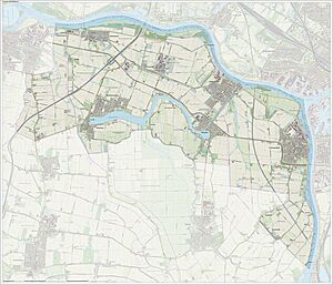
Topography is about the shape and features of the land. This includes things like hills, valleys, rivers, and lakes. A topographic map shows these features in detail.
The map above shows the topography of Binnenmaas in 2015. You can see how the land is laid out, including the water areas that gave the municipality its name.
See also
 In Spanish: Binnenmaas para niños
 | Chris Smalls |
 | Fred Hampton |
 | Ralph Abernathy |


