Kramer, North Dakota facts for kids
Quick facts for kids
Kramer, North Dakota
|
|
|---|---|

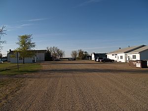
Street in Kramer
|
|

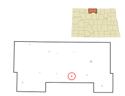
Location of Kramer, North Dakota
|
|
| Country | United States |
| State | North Dakota |
| County | Bottineau |
| Founded | 1905 |
| Area | |
| • Total | 0.15 sq mi (0.40 km2) |
| • Land | 0.15 sq mi (0.40 km2) |
| • Water | 0.00 sq mi (0.00 km2) |
| Elevation | 1,457 ft (444 m) |
| Population
(2020)
|
|
| • Total | 24 |
| • Estimate
(2022)
|
25 |
| • Density | 156.86/sq mi (60.59/km2) |
| Time zone | UTC-6 (Central (CST)) |
| • Summer (DST) | UTC-5 (CDT) |
| ZIP code |
58748
|
| Area code(s) | 701 |
| FIPS code | 38-43500 |
| GNIS feature ID | 1036111 |
Kramer is a small city located in Bottineau County, North Dakota, in the United States. It was founded in 1905. According to the 2020 census, only 24 people lived there.
Where is Kramer Located?
Kramer is in the state of North Dakota. The city covers a total area of about 0.40 square kilometers (0.15 square miles). All of this area is land, meaning there are no large lakes or rivers within the city limits.
How Many People Live in Kramer?
The number of people living in Kramer has changed a lot over the years.
| Historical population | |||
|---|---|---|---|
| Census | Pop. | %± | |
| 1910 | 181 | — | |
| 1920 | 172 | −5.0% | |
| 1930 | 190 | 10.5% | |
| 1940 | 220 | 15.8% | |
| 1950 | 198 | −10.0% | |
| 1960 | 175 | −11.6% | |
| 1970 | 125 | −28.6% | |
| 1980 | 84 | −32.8% | |
| 1990 | 51 | −39.3% | |
| 2000 | 44 | −13.7% | |
| 2010 | 29 | −34.1% | |
| 2020 | 24 | −17.2% | |
| 2022 (est.) | 25 | −13.8% | |
| U.S. Decennial Census 2020 Census |
|||
Population in 2010
In 2010, there were 29 people living in Kramer. These people lived in 16 different homes. Out of these, 12 were families. The city had about 41 housing units in total.
Most of the people living in Kramer in 2010 were White. About 10.3% of the residents were under 18 years old. More than half of the people (55.2%) were 65 years old or older. The average age in the city was 65.8 years.
See also
 In Spanish: Kramer (Dakota del Norte) para niños

