Kruševo Brdo facts for kids
Quick facts for kids
Kruševo Brdo
Kruševo Brdo
|
|
|---|---|
|
Village
|
|
| Country | Bosnia and Herzegovina |
| Entity | Republika Srpska |
| Municipality | Kotor Varoš |
| Time zone | UTC+1 (CET) |
| • Summer (DST) | UTC+2 (CEST) |
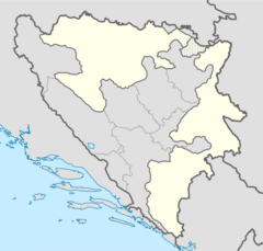
Kruševo Brdo is a small village located in Bosnia and Herzegovina. It is part of the Republika Srpska entity, within the Kotor Varoš municipality. This village is found in a region called Bosanska Krajina. It is divided into two parts: Kruševo Brdo I and Kruševo Brdo II.
Contents
Exploring the Geography of Kruševo Brdo
Kruševo Brdo is nestled in a beautiful natural setting. It sits at the start of the Vrbanja river valley. The village is on the northeastern slopes of the Kruševo Brdo mountain, which is 1,178 meters (about 3,865 feet) high. Another nearby peak is Milanovo brdo, at 1,022 meters (about 3,353 feet).
Rivers and Hills
The Vrbanja river flows through the valley. It eventually joins the Vrbas river near Banja Luka. Kruševo Brdo is made up of many smaller areas called hamlets. These hamlets are spread out on the slopes of the Kruševo and Milan mountains. These mountains are part of the larger Vlašić mountain range.
Some hamlets are on the right side of the Vrbanja river, like Trifunovići, Jankovići, Novakovići, and Gavranovići. On the left slopes, you'll find Potok, Pavlovići, Panići, and Čudnić. The central hamlet is Čudnić, located at 612 meters (about 2,008 feet) above sea level. It's where smaller local roads meet. Two rivers, Bobovica and Čudnić, flow into the Vrbanja here. The Ilomska river flows above the Panići hamlet.
Nearby Places
Here are some places close to the central hamlet of Čudnić:
- Bobovice (2.6 km away)
- Gelići (3.5 km away)
- Jankovići (2.6 km away)
- Javorje (0.2 km away)
- Mali Brić (5.2 km away)
- Novakovići (3.3 km away)
- Pavlovići (5.2 km away)
- Pilipovina (4.8 km away)
- Veliki Brić (4.4 km away)
In the last census from the time of Former Yugoslavia, a total of 793 people lived in both parts of Kruševo Brdo.
A Look into the History of Kruševo Brdo
The area around Kruševo Brdo has a long history. Old records show that people lived here even in Roman times, around the sixth century. Stone monuments called stećci also tell us that people from the Old Bosnian (Bogomil) faith lived here in the twelfth century.
Early Settlements and Kingdoms
In the seventh century, South Slavs settled in this region. They mixed with the people already living there. The first Bosnian State was formed in the 10th century. During the Middle Ages, Kruševo Brdo was part of the old Bosnian state, specifically a province called Donji kraji. Later, in 1519, the Ottomans took control of the area.
Austro-Hungarian Rule and Railways
In 1878, the Austro-Hungarian Monarchy began to rule the region. They stayed until the First Yugoslavia was formed. The Austro-Hungarians built narrow-gauge railway lines. Their main goal was to transport wood and other natural resources. The railway came from Kotor Varoš and branched out in several directions near Šiprage. From Kruševo Brdo, two lines went upstream along the Vrbanja and Bobovica rivers. These old railway paths were later turned into local roads for many villages.
World War II and Beyond
After December 1, 1918, Kruševo Brdo became part of the Kingdom of Serbs, Croats and Slovenians, which later became the Kingdom of Yugoslavia. This lasted until 1941.
During World War II, the nearby area of Šiprage was an important place for partisan units. They even had a hospital there. However, Kruševo Brdo was a stronghold for another group called the Chetniks.
In January 1944, there were battles in the area. The German forces attacked, and the partisan hospital had to move to keep patients safe. About 600 injured people were moved to surrounding villages, including Čudnić and Kruševo Brdo. After the fighting, they returned to Šiprage.
After World War II, Kruševo Brdo was a local community within the Municipality of Šiprage.
Recent History
During the War in Bosnia (1992–95), many villages in the area were affected. People were forced to leave their homes. After 1996, some of the villages were partly rebuilt. This was helped by a group called Battalion BELUGA, part of the SFOR-EUFOR Mission.
 | George Robert Carruthers |
 | Patricia Bath |
 | Jan Ernst Matzeliger |
 | Alexander Miles |


