Kukri Hills facts for kids
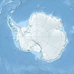
The Kukri Hills (77°44′S 162°42′E / 77.733°S 162.700°E) are a long mountain range in Antarctica. They stretch for about 25 nmi (46 km) from east to west. These hills are very tall, reaching over 2,000 m (6,560 ft) high! They act like a natural wall, separating the Ferrar Glacier to the south from the Taylor Glacier and Taylor Valley to the north. You can find them in a part of Antarctica called Victoria Land.
Explorers first saw these hills during the "Discovery Expedition" between 1901 and 1904. The hills were likely named because their shape looks like a Kukri, which is a special knife used by Gurkha soldiers.
Contents
Famous Mountains in Kukri Hills
This section describes some of the important peaks found within the Kukri Hills.
Mount Barnes
Mount Barnes (77°38′S 163°35′E / 77.633°S 163.583°E) is a peak that stands 985 m (3,232 ft) tall. It is located on the west-central side of New Harbour. This mountain marks the eastern end of the Kukri Hills.
The Discovery expedition, led by Robert Falcon Scott, first saw Mount Barnes between 1901 and 1904. They originally called it "New Harbour Heights." Later, during Scott's second trip, the Terra Nova Expedition (1910–13), it was renamed Mount Barnes. This new name honored a Canadian ice scientist.
Mount Brearley
Mount Brearley (77°48′S 161°45′E / 77.800°S 161.750°E) is a sharp peak that reaches 2,010 m (6,590 ft) high. It is the westernmost mountain in the Kukri Hills.
The "Western Journey Party" named Mount Brearley. This group was part of the British Antarctic Expedition (1910–13) and was led by Thomas Griffith Taylor.
Rahi Peak
Rahi Peak (77°44′S 162°49′E / 77.733°S 162.817°E) is a noticeable mountain that rises to 1,830 m (6,000 ft). It is located between the top of Moa Glacier and Goldman Glacier.
The word "rahi" comes from the Māori language and means "big." The New Zealand Geographic Board (NZGB) gave this name to the peak in 1998.
Sentinel Peak
Sentinel Peak (77°47′S 162°23′E / 77.783°S 162.383°E) is a clear, pointed peak that is over 2,000 m (6,560 ft) tall. It stands on the north side of Ferrar Glacier. This peak is the highest point in the south-central part of the Kukri Hills.
The Discovery expedition (1901–04), led by Scott, found and named Sentinel Peak.
Other Interesting Spots
Besides the main mountains, the Kukri Hills area has other unique features.
Young Hill
Young Hill (77°38′S 163°26′E / 77.633°S 163.433°E) is a hill that is not covered in ice. It is about 1,000 m (3,280 ft) high and is located about 1 mi northeast of Hallam Peak.
The New Zealand Geographic Board (NZGB) named Young Hill in 1998. It was named after Euan C. Young, a New Zealand scientist who studied birds. His research in Antarctica lasted for 30 years, starting in 1959.
Eyeglass Cirque
Eyeglass Cirque is a bowl-shaped valley found 2 mi (3.2 km) east of South America Glacier. It is located on the southern cliffs of the Kukri Hills in Victoria Land.
This name is one of several in the area related to surveying. The New Zealand Geographic Board chose the name in 1993. "Eyeglass" refers to the eyepiece of a surveying telescope.
 | Leon Lynch |
 | Milton P. Webster |
 | Ferdinand Smith |


