Kuparuk River facts for kids
Quick facts for kids Kuparuk River |
|
|---|---|

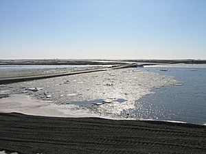
Spring ice breakup in 2011
|
|
|
Location of the mouth of the Kuparuk River in Alaska
|
|
| Native name | Kuukpaaġruk |
| Country | United States |
| State | Alaska |
| Borough | North Slope |
| Physical characteristics | |
| Main source | Brooks Range 2,900 ft (880 m) 68°32′15″N 149°14′46″W / 68.53750°N 149.24611°W |
| River mouth | Gwydyr Bay, Beaufort Sea 8 miles (13 km) southeast of Beechey Point 0 ft (0 m) 70°25′28″N 148°52′15″W / 70.42444°N 148.87083°W |
| Length | 200 mi (320 km) |
| Basin features | |
| Basin size | 3,130 sq mi (8,100 km2) |
The Kuparuk River is a long river in Alaska, a state in the United States. It flows north through a flat, cold area called the North Slope. Eventually, it reaches the Beaufort Sea, which is part of the Arctic Ocean. The river is about 200 miles (320 km) long. It has a wide river delta where it meets the sea.
Contents
About the Kuparuk River
The Kuparuk River is an important waterway in northern Alaska. It starts in the Brooks Range mountains. From there, it travels across the flat, frozen tundra landscape. The river flows into Gwydyr Bay, which is part of the Beaufort Sea.
Where it Flows
The river is about 200 miles (320 kilometers) long. It flows from the mountains in the south towards the Arctic Ocean in the north. Where it meets the sea, the river spreads out into a wide river delta. This delta is about 3 miles (5 kilometers) wide.
What's in a Name?
The name Kuparuk comes from the Iñupiaq language. The Iñupiaq people are native to this part of Alaska. Their name for the river is Kuukpaaġruk.
An early explorer wrote the name as Koopowra in 1901. He thought it meant "Big River." However, the Iñupiaq name Kuukpaaġruk actually means "a smaller version of a big river."
Interesting Features
There is a special hill near the river called Kuparuk Mound. It is about 30 feet (9 meters) tall. This mound is a type of ice-filled hill called a pingo. It is located about 12 miles (19 kilometers) southeast of Beechey Point.
An Arctic explorer named Ernest de Koven Leffingwell named the mound in 1911. He used it as a triangulation station. This means he used it as a fixed point to help map the area.
Oil and the River
The Kuparuk River oil field is located near the river. This oil field is the second largest in North America. It is about 40 miles (64 kilometers) west of Prudhoe Bay.
The oil field was discovered in 1969. It covers a large area of about 500 square miles (1,300 square kilometers). This area is very important for getting oil.
 | Aaron Henry |
 | T. R. M. Howard |
 | Jesse Jackson |


