Kuujjuarapik Airport facts for kids
Quick facts for kids
Kuujjuarapik Airport
|
|||||||||||
|---|---|---|---|---|---|---|---|---|---|---|---|
 |
|||||||||||
| Summary | |||||||||||
| Airport type | Public | ||||||||||
| Operator | Administration régionale Kativik | ||||||||||
| Serves | Kuujjuarapik, Whapmagoostui | ||||||||||
| Location | Kuujjuarapik | ||||||||||
| Time zone | EST (UTC−05:00) | ||||||||||
| • Summer (DST) | EDT (UTC−04:00) | ||||||||||
| Elevation AMSL | 40 ft / 12 m | ||||||||||
| Coordinates | 55°16′55″N 077°45′55″W / 55.28194°N 77.76528°W | ||||||||||
| Map | |||||||||||
| Runway | |||||||||||
|
|||||||||||
| Statistics (2010) | |||||||||||
|
|||||||||||
|
Sources: Canada Flight Supplement
Movements from Statistics Canada |
|||||||||||
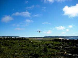
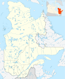
The Kuujjuarapik Airport (IATA: YGW, ICAO: CYGW) is an airport in Quebec, Canada. It is located right next to the Inuit community of Kuujjuarapik. It also serves the nearby Cree community of Whapmagoostui. This airport helps connect these northern communities to other parts of Quebec and Canada.
Flights and Destinations
This airport is a busy place for people traveling in and out of Kuujjuarapik and Whapmagoostui. Several airlines fly here, connecting these towns to bigger cities and other smaller communities.
Airlines that fly here
Where you can fly from here
You can catch flights from Kuujjuarapik Airport to many different places. These include:
- Chisasibi
- Eastmain
- Inukjuak
- Ivujivik
- Kuujjuaq
- La Grande
- Montreal–Trudeau (a major airport in Montreal)
- Puvirnituq
- Salluit
- Sanikiluaq
- Umiujaq
- Val-d'Or
- Waskaganish
- Wemindji
These flights are important for people living in these remote areas. They help them travel for work, school, family visits, and to get supplies.
See also
 In Spanish: Aeropuerto de Kuujjuarapik para niños
 | Percy Lavon Julian |
 | Katherine Johnson |
 | George Washington Carver |
 | Annie Easley |


