LaSalle, Colorado facts for kids
Quick facts for kids
Town of LaSalle, Colorado
|
|
|---|---|

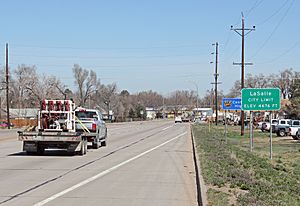
Entering LaSalle from the south on U.S. Route 85.
|
|

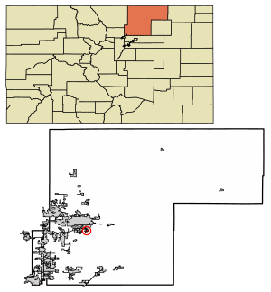
Location of the Town of LaSalle in Weld County, Colorado.
|
|
| Country | |
| State | |
| County | Weld |
| Incorporated (town) | 1910 |
| Government | |
| • Type | Statutory Town |
| Area | |
| • Total | 0.96 sq mi (2.48 km2) |
| • Land | 0.96 sq mi (2.48 km2) |
| • Water | 0.00 sq mi (0.00 km2) |
| Elevation | 4,678 ft (1,426 m) |
| Population
(2020)
|
|
| • Total | 2,359 |
| • Density | 2,457/sq mi (951.2/km2) |
| Time zone | UTC-7 (Mountain (MST)) |
| • Summer (DST) | UTC-6 (MDT) |
| ZIP code |
80645
|
| Area code(s) | 970 |
| FIPS code | 08-43605 |
| GNIS feature ID | 0180726 |
| Website | Town of LaSalle |
The Town of LaSalle is a small town in Weld County, Colorado, United States. It became an official town in 1910.
In 2020, about 2,359 people lived there. A post office has been in LaSalle since 1886. The town was named by railroad workers after a street in Chicago.
Where is LaSalle Located?
LaSalle is in the state of Colorado. You can find it at these coordinates: 40°21′2″N 104°42′10″W / 40.35056°N 104.70278°W.
The town covers a total area of about 2.48 square kilometers (0.96 square miles). All of this area is land.
How Many People Live in LaSalle?
The number of people living in LaSalle has changed over the years. Here's how the population has grown:
| Historical population | |||
|---|---|---|---|
| Census | Pop. | %± | |
| 1920 | 460 | — | |
| 1930 | 564 | 22.6% | |
| 1940 | 755 | 33.9% | |
| 1950 | 797 | 5.6% | |
| 1960 | 1,070 | 34.3% | |
| 1970 | 1,227 | 14.7% | |
| 1980 | 1,929 | 57.2% | |
| 1990 | 1,783 | −7.6% | |
| 2000 | 1,849 | 3.7% | |
| 2010 | 1,955 | 5.7% | |
| 2020 | 2,359 | 20.7% | |
See also
 In Spanish: La Salle (Colorado) para niños

All content from Kiddle encyclopedia articles (including the article images and facts) can be freely used under Attribution-ShareAlike license, unless stated otherwise. Cite this article:
LaSalle, Colorado Facts for Kids. Kiddle Encyclopedia.
