La Estancia, Sonora facts for kids
Quick facts for kids
La Estancia
|
|
|---|---|
| Country | |
| State | Sonora |
| Municipality | Aconchi |
| In Aconchi Municipality | since April 13, 1932 |
| Area | |
| • Total | 0.57 km2 (0.22 sq mi) |
| Elevation | 603 m (1,978 ft) |
| Population
(2010)
|
|
| • Total | 713 |
| • Density | 1,250.8/km2 (3,240/sq mi) |
| Time zone | UTC-7 (MST) |
| Postal code |
84929
|
| Area code(s) | +52 623 |
| INEGI Code | 260010003 |
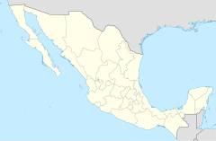
La Estancia is a small village located in the Mexican state of Sonora. It's part of the Aconchi Municipality, found right in the middle of the state. This village is close to the Sierra Madre Occidental mountains.
Discover La Estancia
La Estancia is the second largest community in its municipality. In 2010, about 713 people lived there. This information comes from INEGI, which is like Mexico's statistics agency.
Where is La Estancia Located?
The village is quite close to other places. It's only about 2.5 miles from Aconchi, which is the main town of the municipality. If you wanted to visit the state capital, Hermosillo, it's about 89 miles away.
A Bit of History
La Estancia became an official part of the Aconchi Municipality on April 13, 1932. This happened when a special law, Law number 74, was put into place. La Estancia is one of nine communities that make up the Aconchi Municipality.
See also
 In Spanish: La Estancia (Sonora) para niños
 | William M. Jackson |
 | Juan E. Gilbert |
 | Neil deGrasse Tyson |


