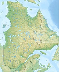
Lac des Martres (Lac-Pikauba) facts for kids
Quick facts for kids Lac des Martres |
|
|---|---|
| Location | Lac-Pikauba |
| Coordinates | 47°50′12″N 70°38′17″W / 47.83667°N 70.63805°W |
| Lake type | Natural |
| Primary inflows | Four discharges of unidentified lakes, discharge of lac Robbé. |
| Primary outflows | Ruisseau des Érables |
| Basin countries | Canada |
| Max. length | 6.4 km (4.0 mi) |
| Max. width | 1.3 km (0.81 mi) |
| Surface elevation | 809 m (2,654 ft) |
Lac aux Martres is a beautiful lake located in the province of Quebec, Canada. Its waters flow into the rivières des Martres and then into the mighty Saguenay River. This journey happens through a series of smaller lakes and a stream called Ruisseau des Érables.
The lake is found in a wild area known as Lac-Pikauba. This area is part of the Charlevoix Regional County Municipality in Quebec.
You can reach the southern part of Lac aux Martres using Quebec Route 381. This road runs along the eastern edge of the Laurentides Wildlife Reserve. Other smaller forest roads also lead to the lake. These roads are used for forestry and fun outdoor activities.
Forestry, which is about managing forests, is the main economic activity here. Tourism and recreation come in second place.
The surface of Lac aux Martres usually freezes from late November to early April. However, it's safest to walk or play on the ice from mid-December to the end of March.
Contents
Discovering Lac aux Martres
Lac aux Martres is nestled between two amazing natural areas. To its east is the Hautes-Gorges-de-la-Rivière-Malbaie territory. To its west is the Grands-Jardins National Park.
Nearby Waters
Many other lakes and rivers are close to Lac aux Martres. Here are some of the main ones:
- North: Freddo Lake, Second Paul Lake, Érables Lake, Croix Lake, Porc-Épic Lake, Carabine Stream.
- East: Rivière du Gouffre, Malbaie River, Petit lac Malfait, Lac du Coeur.
- South: Barley Lake, Petit Malbaie Lake, Écluse Lake, Rivière du Gouffre.
- West: Saguenay River, Baie des Ha! Ha!.
Lake Dimensions
Lac aux Martres is shaped a bit like a boat anchor. It stretches about 6.4 km (4.0 mi) long. The widest part of the lake is about 1.3 km (0.81 mi). The lake sits at an elevation of 809 m (2,654 ft) above sea level.
There's a round-shaped peninsula in the lake. It has a mountain peak that reaches 940 m (3,080 ft) high! A small dam is built at the lake's outlet on its eastern side.
Water Flow and Journey
From Lac aux Martres, the water flows out through the Ruisseau des Érables. This stream travels for about 4 km (2.5 mi) northeast, then northwest. It eventually reaches "Anse aux Cailles" on the south shore of the Saguenay River.
From there, the water joins the Saguenay River. It flows east for about 93.1 km (57.8 mi) to Tadoussac. At Tadoussac, the Saguenay River empties into the mighty Saint Lawrence River.
Why the Name "Lac aux Martres"?
The name "Lac aux Martres" means "Lake of the Martens." This name was first written down in a book called "Dictionary of rivers and lakes of the province of Quebec" in 1914.
In 1886, a land surveyor named F. Vincent described the area. He said the lake was in mountains, surrounded by fir and spruce trees. He also noted that trout were found in its waters.
The name "Martres" comes from the Canada marten. This is a carnivorous mammal, also known as a fisher. Its fur was once very popular for making warm coat collars. So, the lake was named after these animals that lived in the area.
The official name "Lac aux Martres" was formally recognized on December 5, 1968. This was done by the Commission de toponymie du Québec, which is the official body for naming places in Quebec.
Related Places
- Charlevoix Regional County Municipality
- Lac-Pikauba, an unorganized territory
- Rivière aux Martres
- Malbaie River
 | Ernest Everett Just |
 | Mary Jackson |
 | Emmett Chappelle |
 | Marie Maynard Daly |


