Lake Barlee facts for kids
Quick facts for kids Lake Barlee |
|
|---|---|

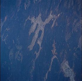
Satellite image
|
|
| Location | Western Australia |
| Coordinates | 29°9′20″S 119°30′50″E / 29.15556°S 119.51389°E |
| Lake type | Intermittent salt lake |
| Primary outflows | evaporation |
| Catchment area | 17,900 km2 (6,900 sq mi) |
| Basin countries | Australia |
| Max. length | 80 km (50 mi) |
| Max. width | 100 km (62 mi) |
| Surface area | 1,980 km2 (760 sq mi) |
Lake Barlee is a huge, flat area in Western Australia that sometimes fills with salty water. It's known as an "intermittent salt lake" because it's usually dry. When it does fill up, it becomes the second largest lake in Western Australia, covering about 1,980 square kilometers (764 square miles)!
Contents
Discover Lake Barlee's Location and Features
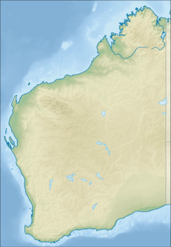
Lake Barlee is located in Western Australia. It sits about 65 kilometers (40 miles) southeast of Youanmi. It is also about 160 kilometers (99 miles) north of Bullfinch. The lake is found right on the border between the areas of Sandstone and Menzies.
How Lake Barlee Forms and Fills
Lake Barlee and other lakes nearby are part of ancient river valleys. These valleys formed millions of years ago. Water flows into them mainly from underground. This groundwater moves through old river channels. These channels are filled with special rocks and clay.
Like many flat, clay areas that are usually dry, Lake Barlee often has no water. But it can fill up when tropical cyclones bring heavy rain after they reach the coast. On average, the lake fills about once every ten years. When it does, the water usually stays for six to nine months.
Islands and Plants of Lake Barlee
When the lake fills, it becomes a very important place for waterbirds to breed. Lake Barlee gets water from direct rainfall and many small creeks. The bottom of the lake is bare, but it has hundreds of rocky islands. These islands are made of greenstone rock and come in different sizes.
The islands are usually less than 10 meters (33 feet) high. They are home to special plants called samphire. When the lake is almost full or overflowing, at least five of these islands can host many breeding birds. The banded stilt is one bird that especially likes to breed here.
History of Lake Barlee and Its Name
The original people of this area are the Mantjintjarra Ngalia peoples. Their traditional lands stretched across a wide region. This included areas from Lake Wells in the east to Lake Darlot and Lake Miranda in the west. Their lands also went from Cosmo Newberry to Leonora and Lake Barlee, up to Wiluna in the north.
How Lake Barlee Got Its Name
Lake Barlee was named by an explorer named John Forrest. He found the lake on May 18, 1869. Forrest and his group were looking for another lost explorer, Ludwig Leichhardt. They got stuck in the mud while trying to cross the salty lake.
After getting their horses free, they traveled around the edge of the lake for almost a week. On May 25, Forrest climbed a hill called Yeedie Hill. From there, he could see how big the lake really was. Forrest decided to name the lake after Frederick Barlee. Barlee was an important government official in Western Australia at the time.
Birds: A Special Place for Waterbirds
Lake Barlee, along with some smaller lakes nearby, is recognized as an Important Bird Area (IBA) by BirdLife International. This means it's a very important place for birds. The area covers about 1,937 square kilometers (748 square miles).
Banded Stilts and Other Breeding Birds
Lake Barlee has supported one of the largest recorded breeding events for the banded stilt. A huge number of nests, 179,000, were counted there! This shows how vital the lake is for these birds.
Other waterbirds also breed at Lake Barlee. These include the black swan, Australian shelduck, and pink-eared duck. You might also find the white-headed stilt and the red-capped plover breeding at the lake.
Gallery
See also
 In Spanish: Lago Barlee para niños
 | Audre Lorde |
 | John Berry Meachum |
 | Ferdinand Lee Barnett |


