Lake Beulah (Arkansas–Mississippi) facts for kids
Quick facts for kids Lake Beulah |
|
|---|---|
 |
|
| Location | Bolivar County, Mississippi, Desha County, Arkansas, United States |
| Coordinates | 33°46′28″N 90°59′36″W / 33.7743825°N 90.9933731°W |
| Lake type | Oxbow lake |
| Basin countries | United States |
| Surface area | 1,031 acres (417 ha) |
| Average depth | between 6 ft (1.8 m) and 20 ft (6.1 m) |
| Surface elevation | 121 ft (37 m) at normal pool |
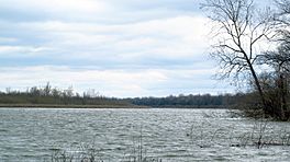
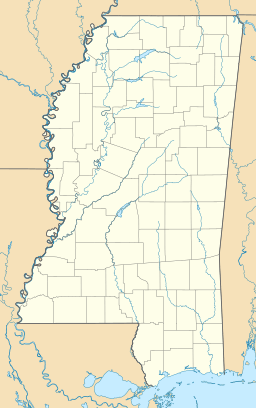
Lake Beulah is a special kind of lake called an oxbow lake. It's located in the United States, right on the border between Bolivar County, Mississippi and Desha County, Arkansas. The border actually runs through the middle of this long, curving lake!
The small town of Beulah, Mississippi is found on the east side of the lake. There's a public boat launch there for everyone to use.
Contents
Lake Life: Plants and Animals
Lake Beulah is home to many interesting plants and animals. The main plant you'll see floating on the water is called duckweed.
Lots of different fish live in the lake too. You might find fish like bowfin, bream, and buffalo. There are also channel catfish, common carp, and crappie. Other fish include drum, green sunfish, gar, and largemouth bass.
How Lake Beulah Was Formed
Lake Beulah wasn't always a lake. It used to be a big bend in the mighty Mississippi River.
The Mississippi River's Old Path
Before the year 1863, the Mississippi River made a huge curve. This curve was about 10 mi (16 km) long and was known as the "Beulah Bend."
During the American Civil War, soldiers from the Confederate States Army used this bend. They would hide in the woods near the bend. From there, they could fire at Union Army ships passing by. The same cannons could hit ships as they entered and left the tight curve.
Creating a New Path
To avoid these attacks, a Union commander named Thomas Oliver Selfridge came up with a plan. He ordered his soldiers to dig a new channel. This channel would cut straight across the land, bypassing the big bend.
The land was soft, and the river's current was strong. Because of this, the new "Napoleon Channel" was dug in just one day! In April 1863, Commander Selfridge himself sailed his ship, the USS Conestoga, through this new shortcut.
From River Bend to Oxbow Lake
Once the new channel was open, most of the Mississippi River's water started flowing through it. The old Beulah Bend was cut off from the main river. Over time, the ends of the old bend filled in with dirt and plants. This is how Lake Beulah became an oxbow lake.
What Happened to Napoleon?
The new Napoleon Channel helped river traffic move faster. But it also changed the river's path. The river now flowed very close to the town of Napoleon. Napoleon was an important town back then.
Sadly, high water levels in 1868 and 1874 caused big problems. Parts of Napoleon were destroyed and permanently covered by water. By 1882, the town of Napoleon was no longer even shown on river maps.


