Lake Chapala facts for kids
Quick facts for kids Lake Chapala |
|
|---|---|
 |
|
| Location | Jalisco / Michoacán, Mexico |
| Coordinates | 20°15′N 103°00′W / 20.250°N 103.000°W |
| Primary inflows | Río Lerma, Río Zula, Río Huaracha, Río Duero |
| Primary outflows | Río Grande de Santiago |
| Basin countries | Mexico |
| Max. length | 80 km (50 mi) |
| Max. width | 18 km (11 mi) |
| Surface area | 1,100 km2 (420 sq mi) |
| Average depth | 7 m (23 ft) |
| Max. depth | 10.5 m (34 ft) |
| Water volume | 8.1 km3 (1.9 cu mi) |
| Surface elevation | 1,524 m (5,000 ft) |
| Islands | 3 |
| Official name: Lago de Chapala | |
| Designated: | 2 February 2009 |
| Reference #: | 1973 |
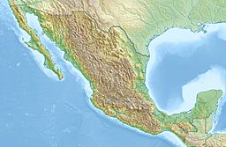
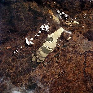
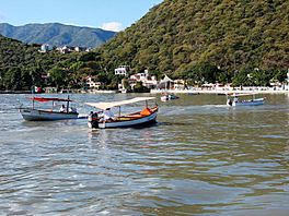
Lake Chapala (called Lago de Chapala in Spanish) is the largest freshwater lake in Mexico. It is located in the states of Jalisco and Michoacán. Many towns and cities are found along its shores, including Chapala and Ajijic.
Contents
Discovering Lake Chapala
Where is Lake Chapala Located?
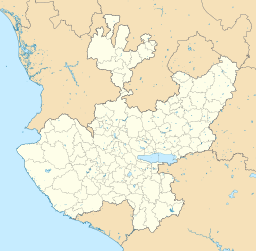
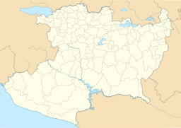
Lake Chapala is about 45 kilometres (28 mi) southeast of Guadalajara, Jalisco, a major city in Mexico. It sits right on the border between the states of Jalisco and Michoacán. The lake is high up, at 1,524 metres (5,000 ft) (about 5,000 feet) above sea level.
How Big is Lake Chapala?
The lake is quite large! It stretches about 80 km (50 mi) from east to west. Its width averages about 12.5 kilometres (7.8 mi) (7.8 miles) from north to south. In total, it covers an area of about 1,100 km2 (420 sq mi).
How Deep is Lake Chapala?
Even though it's very wide, Lake Chapala is not very deep. Its average depth is only 7 metres (23 ft). At its deepest point, it reaches about 10.5 m (34 ft).
Rivers that Feed and Drain the Lake
Several rivers flow into Lake Chapala, bringing it water. These include the Río Lerma, Río Zula, Río Huaracha, and Río Duero. The lake's water then normally flows out into the Río Grande de Santiago, which eventually leads to the Pacific Ocean. However, for over 30 years, no water has flowed out of the lake. This is because less water has been coming in from the Lerma River.
Islands in Lake Chapala
Lake Chapala has three small islands:
- Isla de los Alacranes: This island is easiest to see from the town of Chapala.
- Isla Mezcala: This is the largest island. It has an old Spanish fort and a former Mexican prison.
- La Isla Menor: This is a very tiny island right next to Isla Mezcala.
Mountains Around Lake Chapala
Many mountains and sierras (mountain ranges) surround Lake Chapala. Some of these include Cerro Viejo-Chupinaya-Los Sabinos, Cerro San Miguel-Chiquihuitillo, and Cerro San Bartolo-Los Ocotes.
Lake Chapala's Environment
Why is Lake Chapala Important?
Since the 1950s, the city of Guadalajara has used Lake Chapala as its main source of drinking water.
Changes in Water Level
After the 1950s, there were a few years with not much rain. This caused the lake's water level to drop a lot. The water level went back up until 1979. After that, it started dropping quickly again. This was mainly because more people in cities were using the lake's water.
Cutting down trees around the lake and along the Lerma River has caused soil to wash into the lake. This makes the lake shallower. A shallower lake also means the water gets warmer, which causes more water to evaporate.
Water Quality and Pollution
Sadly, the water in Lake Chapala has also become polluted. This pollution comes from cities, factories, and farms, mostly from the Lerma River. The extra nutrients from this pollution, combined with warmer water, have helped an invasive plant called water hyacinth grow very quickly.
The pollution has greatly harmed the lake's environment. The number of fish has gone down a lot. Some types of fish found only in this lake are now close to disappearing. Eating contaminated fish has also become a risk for people who rely on them for food.
In 2004, the Global Nature Fund named Lake Chapala the "Threatened Lake of the Year." This showed how worried people were about its future.
By 2007 and 2008, the lake's water level had increased quite a bit. However, it still hasn't reached the levels it had in 1979. Even though there are now water treatment plants along the Lerma River, the lake still faces pollution. In 2017, experts said the water quality was a risk to public health. By 2018, the lake's water level was at 81.68% of its full capacity, which was an improvement from 66.66% in 2017.
Habitat and Species
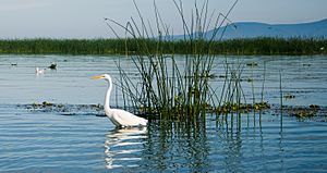
Lake Chapala is a very important home for many animals and plants. It's a critical spot for several types of migratory birds, like the American white pelican. Thousands of native plants and animals also live here. Bird watchers hold an annual Christmas Bird Count at the lake. In 2011, they recorded about 173 different bird species!
The lake is home to unique animals. For example, a special type of rough-footed mud turtle lives mostly in Lake Chapala. The harmless, semi-aquatic obscurus subspecies of the Mexican garter snake is also found only here.
Many fish species, including the "charales" (a group of Chirostoma fish), live in the lake and its rivers. Other unique fish include several goodeids, chubs, lampreys, catfish, and the Chapala chub. Sadly, many of these unique species are now highly endangered. Four types of crayfish, like Cambarellus chapalanus, are also found only in this lake system.
Communities Around Lake Chapala
Many towns and cities are located along the shores of Lake Chapala. These include San Juan Tecomatlan, Chapala, Ajijic, Jocotepec, and Ocotlán.
People from other countries have been interested in Lake Chapala for a long time. Tourism started in the 1800s and grew in the early 1900s. Since the 1950s, many retirees, especially from the United States and Canada, have moved to live along the lake's shore. They enjoy the pleasant climate and beautiful scenery. About 30,000 foreign residents now live around Lake Chapala, especially in towns like Ajijic and Chapala.
See also
 In Spanish: Lago de Chapala para niños
- Concheros
- Coca people
 | Misty Copeland |
 | Raven Wilkinson |
 | Debra Austin |
 | Aesha Ash |


