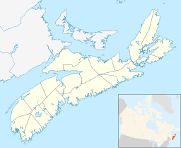
Lake Charles (Nova Scotia) facts for kids
Quick facts for kids Lake Charles |
|
|---|---|
| Location | Halifax Regional Municipality, Nova Scotia |
| Coordinates | 44°43′11.5″N 63°32′59.9″W / 44.719861°N 63.549972°W |
| Primary outflows | Shubenacadie Canal Williams Lake 70% Lake Micmac 30% |
| Basin countries | Canada |
| Max. length | 3.24 km (2.01 mi) |
| Max. width | 0.6 km (0.37 mi) |
| Surface area | 1.46 km2 (0.56 sq mi) |
| Average depth | 15 m (49 ft) |
| Max. depth | 28 m (92 ft) |
| Surface elevation | 31 m (102 ft) |
| Frozen | 2 months |
| Islands | 2 |
| Settlements | Dartmouth, Waverley |
Lake Charles is a beautiful lake located in Nova Scotia, Canada. It's found within the Halifax Regional Municipality, nestled between the towns of Dartmouth and Waverley. The lake is surrounded by important roads, making it easy to access.
Lake Charles is a special part of the Shubenacadie Canal system. It's like the highest point, or "summit," of the canal, sitting about 31 meters (102 feet) above sea level. Water from the lake eventually flows into the Bay of Fundy. However, some of its water also reaches Halifax Harbour through the canal's locks, especially near Shubie Park.
Exploring Lake Charles
Lake Charles is a popular spot for outdoor activities. Its location makes it a great place for people living nearby to enjoy nature.
The Lake Charles Trail
One of the best ways to experience Lake Charles is by walking or biking on the Lake Charles Trail. This trail is part of the much larger Trans Canada Trail, which stretches across Canada.
The trail runs along the western side of Lake Charles. It starts near Shubie Park and goes all the way to the Highway 107 overpass in Portobello. The trail is about 4.39 kilometers (2.7 miles) long. It has a smooth surface made of crushed stone, which is great for walking, running, or cycling.
People use the Lake Charles Trail all year round. It's a well-maintained path, looked after by the Halifax Regional Municipality. It's a perfect place to get some exercise and enjoy the scenery around the lake.
 | Laphonza Butler |
 | Daisy Bates |
 | Elizabeth Piper Ensley |


