
Halifax Harbour facts for kids

_p0749_HALIFAX.jpg)
Halifax Harbour is a big, natural harbour on the Atlantic Ocean coast of Nova Scotia, Canada. It's located in the Halifax Regional Municipality. Halifax exists mostly because of this harbour, which is one of the largest and deepest natural harbours in the world that doesn't freeze in winter. Long ago, it was a very important trading port on the Atlantic coast. In 1917, it was the site of the world's biggest accidental explosion made by people, when the ship SS Mont-Blanc blew up during the Halifax Explosion on December 6.
The harbour was formed when a valley, carved by glaciers, filled with water as the sea level went up after the Ice Age. The Sackville River now flows into the top part of the harbour, called Bedford Basin. The harbour also includes the Northwest Arm and a narrow passage called The Narrows, which leads to Bedford Basin.
For about 200 years, dirty water from homes was dumped directly into Halifax Harbour. This caused health problems in the 1990s, and all the beaches in the harbour had to close. The Harbour Solutions project started in 2000. It was a big project costing about $400 million (Canadian dollars) to clean up the area. It helped, but there's still work to do.
Contents
Exploring Halifax Harbour
The Mi'kmaq First Nation calls the harbour Jipugtug, which sounds like Chebucto. The harbour stretches from the northwest to the southeast.
Imagine ships sailing across the ocean. Halifax Harbour is located about one hour's sailing time north of the main shipping route between the Eastern Seaboard of North America and Europe. This makes it a very convenient first stop for ships coming from Europe and the last stop for ships heading there from North America, especially because it has train connections across the continent.
The harbour was mainly formed by a valley that was once filled with glaciers. As the glaciers melted and the sea level rose, the valley filled with water. The Sackville River flows into the top part of the harbour, in Bedford Basin. Even though the river is smaller now, its original path under the water has been mapped all the way through the harbour.
The harbour has a few main parts:
- Northwest Arm: This is another valley that filled with water. It's mostly used by boats for fun.
- The Narrows: This is a tight passage that leads to Bedford Basin.
- Bedford Basin: This is a calm, sheltered bay and the largest part of the harbour.
Islands in the Harbour
Halifax Harbour has several small islands. The biggest island, McNabs Island, actually forms the northern edge of the harbour's official boundary. The largest island completely inside the harbour is Georges Island. It's a rounded hill made by glaciers, much like Citadel Hill on the mainland. There are also a few tiny islands in Bedford Basin near Bedford and Burnside.
In the Northwest Arm, there's a small piece of land called Deadman's Island. It got its name because prisoners of war from the War of 1812 were buried there. Just a short distance away is Melville Island, which is connected to the mainland by a road. Melville Island is home to the Armdale Yacht Club.
Even though they are just outside the main harbour limits, Lawlor Island and Devils Island are often mentioned when people talk about Halifax Harbour and the nearby areas.


For ships, the official boundary of Halifax Harbour is a line from Herring Cove on one side to the northern tip of McNabs Island, and then from McNabs Island to Eastern Passage on the other side. The harbour has many buoys and lighthouses to guide ships. The Sambro Island Lighthouse, at the entrance to the harbour, is the oldest working lighthouse in North America.
Big ships that need deep water must use the main channel into the harbour. This channel runs along the west side of McNabs Island. The starting point for this inner path is near Chebucto Head, about 12 kilometers (7.5 miles) south of the harbour limit.
Smaller ships (less than 2.5 meters or 8.5 feet deep) can use the Eastern Passage, which is on the east side of McNabs Island. However, this passage often fills with sand, so the water depth can change.
Large ships must have a special harbour pilot guide them. These pilots board the ships near Chebucto Head. Ships wanting to go through The Narrows, between the outer harbour and Bedford Basin, must travel one at a time. This rule was put in place after the terrible Halifax Explosion on December 6, 1917. In that disaster, a French ship carrying explosives, the Mont-Blanc, crashed into a Norwegian ship, the Imo, destroying parts of Halifax and Dartmouth.
The Royal Canadian Navy (RCN) has a large base for its Atlantic fleet, called Maritime Forces Atlantic (MARLANT), along the western side of The Narrows. They also have an ammunition storage area (CFAD Bedford) on the northeastern shore of Bedford Basin. There are strict safety rules for ships sailing near these Navy areas.
Two large suspension bridges cross The Narrows:
- The Angus L. Macdonald Bridge, opened in 1955.
- The A. Murray MacKay Bridge, opened in 1970.
Busy Port Facilities

After Canada became a country in 1867, people in Halifax hoped the government would help make their city's natural harbour Canada's main winter port for trade with Europe. Halifax was a great choice because it was close to Europe compared to other North American ports. However, the new Intercolonial Railway (ICR) took a longer route, and the government didn't do much to promote Halifax as a winter port. Most Canadian businesses sent their goods through American ports like Boston or Portland. People who wanted to promote the harbour worked hard to get money for big port facilities, and they finally succeeded just before World War I. That's when construction started on the large docking areas at Ocean Terminals in Halifax's South End. The war finally made Halifax's harbour very important for shipping across the North Atlantic.
The Halifax Port Authority is a government agency that manages and runs many of the port's properties in the harbour. It used to be run by a national board, but now it's managed by a local organization.
Some of the facilities run by the Halifax Port Authority include:
- South End Container Terminal: This is where large container ships load and unload. It has huge cranes.
- Halifax Grain Elevator: A place to store and load grain onto ships.
- Ocean Terminals: Piers 23-34.
- Piers 20-22: This area includes Pier 20, the Halifax Seaport Farmers Market, the Cruise Ship Pavilion, and the Pier 21 Museum.
- Richmond Terminals: Piers 9 and 9A.
- Richmond Offshore Terminals: Piers 9B-9D. These are used to supply ships and platforms for oil and gas exploration.
- Fairview Cove Container Terminal: Another place for container ships.
- National Gypsum Wharf: Used by a company to load gypsum onto ships.
- Woodside Atlantic Wharf: Used for repairing ships and servicing oil platforms.
- Imperial Oil Wharves: Used by Imperial Oil for their oil refinery in Dartmouth.
- Ultramar Oil Wharves: Used by Ultramar for their petroleum storage.
- Eastern Passage Autoport: Used by CN to handle cars coming in and out of the port.
All these facilities are connected by the CN railway. This railway provides daily train service to major cities like Montreal, Toronto, Detroit, and Chicago. CN also runs the Halifax Intermodal Terminal (HIT) next to the Richmond Terminals.
Besides the Halifax Port Authority, other groups also have facilities in the harbour:
- The Halifax Shipyard, run by Irving Shipbuilding, builds and repairs medium-sized ships. It has two floating drydocks and other repair areas. They are currently expanding for new naval ship construction.
- The Royal Canadian Navy (RCN) operates the HMC Dockyard, Dockyard Annex, CFAD Bedford, and York Redoubt through CFB Halifax. There are also military docking areas near the Shearwater Heliport.
- The Canadian Coast Guard runs CCG Base Dartmouth. This is where part of their Atlantic and Arctic fleets are based, and they also handle pollution response and maintain navigation aids.
- The Bedford Institute of Oceanography has docks for various government science ships. Shannon Hill, above the BIO campus, is also home to the Coast Guard's "Halifax Marine Communications and Traffic Services," which manages ship traffic in the harbour.
- There are several places for pleasure boats (marinas) in the harbour:
- Armdale Yacht Club (Northwest Arm)
- Bedford Basin Yacht Club (Bedford)
- Dartmouth Yacht Club (Wrights Cove)- Burnside
- Royal Nova Scotia Yacht Squadron (Northwest Arm)
- St. Mary's Boat Club (Northwest Arm)
- Waegwoltic Club (Northwest Arm)
- There are 2 automatic Weather stations in the harbour:
- McNabs Island
- Weather buoy Station 44258
Shipwrecks and Hidden Treasures

Halifax Harbour is known for having many shipwrecks, both inside and near its entrance. A few ships were sunk by German U-Boats during World War II near the harbour's approaches, but most were lost due to accidents within the harbour itself. Maps of the harbour show about 45 shipwrecks. Near the harbour's mouth, over 50 magnetic spots have been found, most of which are also shipwrecks, with many others buried under the muddy bottom. All old shipwrecks in Halifax Harbour are protected by Nova Scotia's Special Places Act, which means it's against the law to take anything from them without a special permit.
Here are some interesting shipwrecks, listed by when they sank:
- SS Havana, April 26, 1906: This ship was hit by another steamer, the Strathcona, at night while it was anchored.
- Deliverance, June 15, 1917
- SS Mont-Blanc, blown up in the Halifax Explosion. This was the world's largest accidental explosion made by people. Pieces of the ship still remain.
- Good Hope, March 16, 1929
- Kaaparen, June 14, 1942: This ship crashed into another while they were forming a convoy.
- Erg, July 6, 1943: This shipyard tugboat sank after a collision in Bedford Basin, and 19 lives were lost.
- Governor Cornwallis, December 22, 1944: Sank due to a fire.
- Clayoquot, December 24, 1944
- A barge in Bedford Basin sank as a result of the Bedford Magazine Explosion on July 18, 1945.
- Athelviking, Torpedoed by German submarine U-1232 on January 14, 1945.
- SS British Freedom, sunk on the same day as the Athelviking by U-1232.
- Gertrude de Costa, March 18, 1950
Images for kids
-
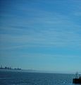
Fog creeping into the Halifax Harbour on a sunny day.

