Shubenacadie Canal facts for kids
Quick facts for kids Shubenacadie Canal |
|
|---|---|

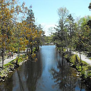
View of Shubenacadie Canal in Shubie Park.
|
|
| Country | Canada |
| Coordinates | 44°42′6.5″N 63°33′15.6″W / 44.701806°N 63.554333°W |
| Specifications | |
| Length | 114 km (71 mi) |
| Maximum boat length | 114 km long |
| Locks | 1 operational (Lock 5) (originally 9 locks & 2 inclined planes) |
| Maximum height above sea level | 31 m (102 ft) at Lake Charles |
| Status | Closed |
| History | |
| Original owner | Shubenacadie Canal Co. |
| Principal engineer | Francis Hall |
| Construction began | 1826 |
| Date of first use | 1856 |
| Date completed | 1861 |
| Date closed | 1871 |
| Geography | |
| Direction | North/South |
| Start point | Halifax Harbour (Dartmouth, Nova Scotia) |
| End point | Cobequid Bay (Maitland, Nova Scotia) |
| Beginning coordinates | 44°40′N 63°34′W / 44.66°N 63.56°W |
| Ending coordinates | 45°19′N 63°29′W / 45.32°N 63.49°W |
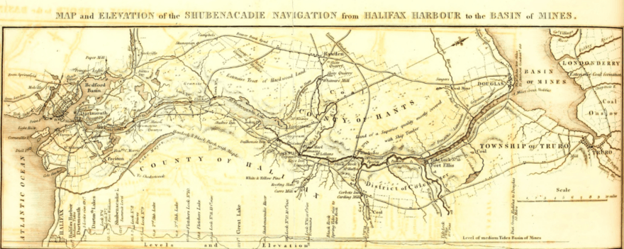
The Shubenacadie Canal is a historic waterway in central Nova Scotia, Canada. It connects Halifax Harbour to the Bay of Fundy. This connection happens through the Shubenacadie River and Shubenacadie Grand Lake.
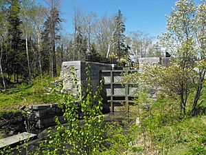
Building the canal started in 1826. It was finally finished in 1861. However, it closed just ten years later, in 1871. Today, small boats can still use parts of the river and lakes. Only one of its original locks is still working. Three of the nine locks have been fixed up. This helps show their special mix of British and North American building styles. There are plans to fix up even more of the canal.
Contents
History of the Shubenacadie Canal
The idea for the Shubenacadie Canal started a long time ago. William Owen first explored the area in 1767. He suggested building a canal about 30 years later. The government of Nova Scotia asked Owen to map the Shubenacadie waterway. This waterway stretched from the Atlantic Ocean to Cobequid Bay.
Why the Canal Was Built
The main goal of the Shubenacadie Canal was to make travel easier. It would connect Halifax with northern Nova Scotia. This northern area was important for farming, timber, and coal. The canal would also link to the Annapolis Valley.
Building Challenges and Delays
Construction began in 1826. The company in charge, the Shubenacadie Canal Co., went out of business in 1831. This left many skilled stonemasons from Scotland and Ireland without work. They had moved to Nova Scotia just for this project.
Work on the canal started again in 1854. A new company, the Inland Navigation Company, took over. They changed the original British designs. They used cheaper North American stone and wood for building. Steam boats and barges began using the canal in 1856. The whole system was finally completed by 1861.
Short-Lived Success
The canal was busy for a few years. It was especially popular during the Waverley gold rushes in the 1860s. However, the canal company did not make much money. They also had problems with cold winters. The freezing temperatures damaged the locks that connected the freshwater lakes.
The president of the Canal company was a politician named Michael Wallace.
The Canal's Closure
The canal's many construction delays led to another big decision. In 1851, Nova Scotia's government decided to build the Nova Scotia Railway. This railway built lines from Halifax to Windsor and Truro by 1858. The railway actually helped the canal at first. It created more traffic for a short time.
But in 1870, the Intercolonial Railway decided to change a bridge. They replaced the Waverley drawbridge over the canal with a fixed bridge. This meant canal steamships could no longer pass. It greatly reduced canal traffic. The final reason for the canal's closure was a decision by the Town of Dartmouth. They took over the Dartmouth Lakes for the city's water supply. This stopped canal operations in 1871.
The Canal's Route
The community of Maitland was named after Governor General of Nova Scotia Peregrine Maitland. This happened when the canal was first attempted (1826–1831). The canal was planned to start at Maitland, Nova Scotia. It would run through the province to Maitland Street in Dartmouth. So, the canal was "bookended" by two "Maitland" places.
The canal followed this path, going north from Halifax Harbour:
- Dartmouth Cove in Dartmouth (part of Halifax Harbour)
- Dartmouth Inclined Plane (no longer there)
- Sullivan's Pond
- Lock One (partially fixed)
- Lake Banook
- Lake Micmac
- Lock Two in Shubie Park (partially fixed but not working)
- Lock Three also in Shubie Park (fully fixed but not working)
- Lake Charles
- Porto Bello Inclined Plane (no longer there)
- Lake William
- Lake Thomas
- Lock Four (in ruins)
- Fletchers Lake
- Lock Five (fully fixed and working)
- Shubenacadie Grand Lake from Wellington Station to Frenchmans Road
- Locks Six to Nine on the Shubenacadie River from Frenchmans Road to Lantz (no longer there)
- Shubenacadie River from Lantz to Maitland
- Cobequid Bay at Port Maitland (part of Minas Basin/Bay of Fundy)
Present Use and Restoration
In recent decades, some parts of the canal have not been used for boating due to environmental concerns. People in Dartmouth wanted to fix parts of the canal's route. This would allow pleasure boats to use the lakes from Halifax Harbour to Shubenacadie Grand Lake.
However, new highways have built low bridges. These bridges cross the connections between Lake Banook and Lake Micmac (Highway 111), and Lake Thomas (Highway 102). This blocks larger boats from using the historic canal route. Still, canoes and small pleasure boats can often pass underneath.
Shubenacadie Canal Commission
The Shubenacadie Canal Commission was created to help. Their goal is to stop the remaining locks from falling apart. They also try to fix some of them so they can work again.
There is a special place to learn about the canal. It is called the Fairbanks Centre in Dartmouth's Shubie Park. This center is right by Lake Micmac. It is also next to one of the restored locks. The Fairbanks Centre has a small model that shows how canal locks work.
Recreational Areas
Many areas along the Shubenacadie Canal are popular for outdoor fun. These spots are enjoyed by people in the Halifax Regional Municipality. Some of these places include:
- Lake Banook's course for competitive paddling.
- Lake Banook's Birch Cove Beach.
- Shubie Park's Dartmouth Multi-use Trail.
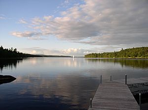
- Laurie Provincial Park on the shore of Shubenacadie Grand Lake.
- Oakfield Provincial Park on the shore of Shubenacadie Grand Lake.
The Trans-Canada Trail is also being planned. It will run alongside part of the canal.
Environmental Concerns: Dartmouth Crossing Silt Run-off
In 2005, environmental groups and local residents became worried. They found that a lot of silt was flowing from the Dartmouth Crossing mall construction site. This silt was going into the canal. After heavy rains from a hurricane, water from the construction site overflowed. This water, carrying silt, ran into the canal, Lake Charles, Lake Micmac, and Shubie Park's Grassy Brook.
Dartmouth Crossing is located near Highway 118, across from Shubie Park. Steps were taken to control the silt run-off. Construction on the mall project then continued.
 | Emma Amos |
 | Edward Mitchell Bannister |
 | Larry D. Alexander |
 | Ernie Barnes |


