Lake Isabella, Michigan facts for kids
Quick facts for kids
Lake Isabella, Michigan
|
|
|---|---|
|
Village
|
|

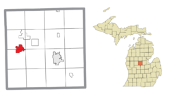
Location within Isabella County
|
|
| Country | United States |
| State | Michigan |
| County | Isabella |
| Townships | Broomfield and Sherman |
| Incorporated | 1998 (village) |
| Government | |
| • Type | Council–manager |
| Area | |
| • Total | 4.62 sq mi (11.95 km2) |
| • Land | 3.48 sq mi (9.01 km2) |
| • Water | 1.14 sq mi (2.94 km2) |
| Elevation | 781 ft (238 m) |
| Population
(2020)
|
|
| • Total | 1,829 |
| • Density | 525.73/sq mi (202.96/km2) |
| Time zone | UTC-5 (Eastern (EST)) |
| • Summer (DST) | UTC-4 (EDT) |
| ZIP code(s) |
48893
|
| Area code(s) | 989 |
| FIPS code | 26-69640 |
| GNIS feature ID | 0636218 |
Lake Isabella is a small village in Michigan, a state in the United States. It is located in Isabella County, and parts of it are in Sherman Township and Broomfield Township.
The village has been growing quite fast. In 2010, its population was 1,681 people. This was a big jump from 2000, showing a 35% increase. From 1990 to 2010, the population grew by 160%! Lake Isabella shares its postal code, 48893, with nearby towns.
Contents
About Lake Isabella's Location
Lake Isabella covers a total area of about 4.65 square miles (11.95 square kilometers). Most of this area, about 3.51 square miles (9.01 square kilometers), is land. The rest, about 1.14 square miles (2.94 square kilometers), is water.
People and Growth in Lake Isabella
| Historical population | |||
|---|---|---|---|
| Census | Pop. | %± | |
| 2000 | 1,243 | — | |
| 2010 | 1,681 | 35.2% | |
| 2020 | 1,829 | 8.8% | |
| U.S. Decennial Census | |||
Lake Isabella saw a lot of growth in the late 1990s and early 2000s. The village officially became a village in May 1998. Since then, many new homes have been built. Over 250 new homes were built after the year 2000.
The village also started to develop its small downtown area. In 2007, a new Village Hall was built. This building provides over 2,000 square feet (185 square meters) for meetings and offices.
Lake Isabella is the second-largest village in Michigan when you look at its land area. In 2000, it was the 71st largest village in the state by population. It also has a large network of streets, about 27 miles long. This is the second-largest street network for any village in Michigan.
Population in 2010
In 2010, a count of the population, called a census, showed there were 1,681 people living in Lake Isabella. These people lived in 694 households, and 507 of these were families. The village had about 479 people per square mile (185 people per square kilometer).
Most of the people in the village were White (95.1%). There were also smaller numbers of African American, Native American, and Asian residents. About 3.6% of the population identified as Hispanic or Latino.
About 29.1% of households had children under 18 living there. Most households (62.2%) were married couples. The average household had 2.41 people, and the average family had 2.80 people.
The average age in the village was 41.1 years old. About 22.4% of residents were under 18. About 17.8% were 65 years or older. The population was almost evenly split between males (49.0%) and females (51.0%).
See also
 In Spanish: Lake Isabella para niños


