Lake Manchar facts for kids
Quick facts for kids Manchar |
|
|---|---|
 |
|
| Location | Lake Manchar is located at a distance of 18 kilometers from Sehwan Sharif on west side of the River Indus, in district Jamshoro. |
| Coordinates | 26°25′N 67°41′E / 26.41°N 67.68°E |
| Lake type | reservoir |
| Part of | Indus River basin |
| Primary inflows | Aral Wah Canal, Danister Canal, Nai Gaj |
| Primary outflows | Indus River |
| Basin countries | Pakistan |
| Max. length | 23.5 km (14.6 mi) |
| Max. width | 12.08 km (7.51 mi) |
| Surface area | 228 to 250 km2 (88 to 97 sq mi) |
| Max. depth | 5 m (16 ft) |
| Water volume | 600,000 acre⋅ft (740,000,000 m3) |
| Surface elevation | 35 m (115 ft) |
| Islands | various islands and islets |
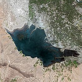
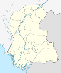
Lake Manchar (Sindhi: منڇر ڍنڍ, Urdu: منچھر جھیل), also spelled Manchhar, is the largest natural freshwater lake in Pakistan. It is also one of the biggest lakes in South Asia. You can find it west of the Indus River, in Jamshoro District and Dadu District, Sindh. It's about 18 kilometers away from Sehwan Sharif.
Lake Manchar collects water from many small streams that flow down from the Kirthar Mountains. Then, its water flows into the Indus River. The size of the lake changes with the seasons. It can be as small as 36 square kilometers. But during heavy monsoon rains, it can grow to as large as 500 square kilometers!
History of Lake Manchar
The area around Lake Manchar has a very long history. You can find ancient places like Ghazi Shah Mound, Wahi Pandhi, and Ali Murad Mound near its banks. Some of the oldest sites, like Lal Chatto, Mashak Lohri, and Lakhiyo, date back to the Harappan culture. This shows that people have lived near this lake for thousands of years.
The lake first formed from a branch of the Indus River that flowed from Kashmore. Later, in 1921, a channel called the Main Nara Valley Drain connected it to Hamal Lake.
Sometimes, the lake has faced tough times. In 1958, it completely dried up because of a long period without rain. But in 2009, a lot of water was added back into the lake from the Indus River. In 2010, during the 2010 Pakistan floods, the lake became very full and overflowed.
During the 2022 Pakistan floods, the lake overflowed again. Engineers worked hard to help the water drain away. They made a cut in the lake to protect the city of Sehwan and the town of Bhan Syedabad. This was a difficult decision, as it caused flooding in some villages. However, it helped protect up to 500,000 people from the floods.
Geography and Water Flow
Lake Manchar is located just south of Hamal Lake. These two lakes are connected by the Main Nara Valley Drain, which was built in 1921. As mentioned, Lake Manchar's size changes a lot. It can be anywhere from 200 to 500 square kilometers during the monsoon season.
The lake is not very deep, usually only about 2.5 to 3.75 meters. It is also about 6 meters lower than the bed of the Indus River. This means that sometimes, during floods, water from the Indus flows into the lake. In winter, when the river water is low, water flows from the lake back into the Indus. The lake gets a lot of freshwater from canals, and the area usually gets about 4.46 inches of rain each year.
The southern part of the lake is at the bottom of the Laki Hills. These hills are part of the Kirthar Mountains. Water flows from the lake to the Indus River through channels like the Aral and Danister Canals.
Environmental Challenges
Lake Manchar is very important for thousands of fisherfolk. These people, sometimes called the "Boat People," depend on the freshwater fish in the lake for their living.
However, the lake has faced some environmental problems. Since the Main Nara Valley Drain was built in 1921, sewage water has flowed into the lake. This has made the water quality much worse.
Also, less freshwater flows into the lake from the Indus River and the Kirthar Mountains. This has caused the lake water to become salty, which is bad for the fish. Salty water from farms in Balochistan and nearby areas also flows into the lake.
These changes have hurt the lake's wildlife. Lake Manchar used to be a resting spot for Siberian migratory birds on their long journeys. But the number of birds has dropped a lot. In 1988, about 25,000 birds were counted, but by 2002, only 2,800 were seen. This is because the lake no longer has enough fish, which are the birds' main food. Now, the lake has more salty water reeds instead of fish.
The lake also used to provide a lot of water for farming. But this has also been reduced, meaning less land can be watered by the lake. To help save the lake from pollution, a project called the Right Bank Outfall Drain is being built. Also, the Nai Gaj Dam is being built upstream. This dam will release freshwater into the lake all year round, not just during certain seasons. This should help improve the lake's water quality and bring back its natural balance.
See also
 In Spanish: Lago Manchar para niños
- Environmental degradation
- Indus River
- List of lakes of Pakistan
- Kalankar lake
 | Sharif Bey |
 | Hale Woodruff |
 | Richmond Barthé |
 | Purvis Young |


