Lake Saint-Charles facts for kids
Quick facts for kids Lake Saint-Charles |
|
|---|---|
 |
|
| Location | Capitale-Nationale, Quebec |
| Coordinates | 46°56′28″N 71°23′14″W / 46.94111°N 71.38722°W |
| Type | Dam lake |
| Primary inflows | (Sens horaire, à partir de l'embouchure) Ruisseau de la Courte Botte, ruisseau Talbot (via la Baie Charles-Talbot), décharge du Lac Delage, rivière des Hurons. |
| Primary outflows | Saint-Charles River |
| Catchment area | 167.7 km2 (64.7 sq mi) |
| Basin countries | Canada |
| Max. length | 5.5 km2 (2.1 sq mi) |
| Max. width | 1.2 km2 (0.46 sq mi) |
| Surface area | 3.6 km2 (1.4 sq mi) |
| Max. depth | 16.5 m (54 ft) |
| Water volume | 14,810,000 m3 (523,000,000 cu ft) |
| Surface elevation | 150.42 m (493.5 ft) |
| Settlements | Quebec City, Stoneham-et-Tewkesbury |
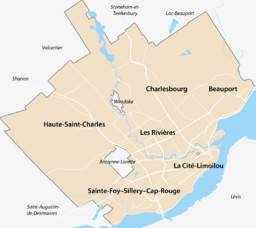
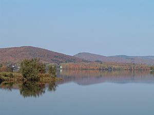
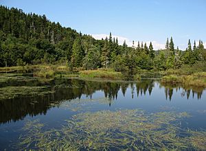
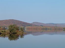
Lake Saint-Charles (French: Lac Saint-Charles) is a beautiful lake in the Capitale-Nationale region of Quebec, Canada. It's partly in Quebec City and partly in the area of Stoneham-et-Tewkesbury.
This lake is super important because it's where the Saint-Charles River begins. It's also a key natural spot for people living near Quebec City. The lake is less than 20 minutes from downtown Quebec City.
You can reach Lake Saint-Charles by roads on its east and west sides. These roads are used for fun activities and for forestry work. The lake's surface usually freezes from early December to late March. It's generally safe to walk or play on the ice from late December to early March.
Contents
Lake Saint-Charles: A Natural Wonder
Lake Saint-Charles is bordered by Quebec City and the areas of Stoneham-et-Tewkesbury. Parts of its watershed are also managed by Lac-Delage and Charlesbourg.
The Cyrille-Delage dam helps control the lake's water level. This is because the lake acts as a reservoir, providing drinking water for Quebec City. The original dam was built in 1934 and replaced in 1948. Because of the dam, the lake's water level is about 2 meters higher than it used to be. This change has affected the lake's natural balance.
In 2006, scientists found blue-green algae, also called cyanobacteria, in the lake. Experts are studying why this happened. Steps have been taken to reduce things that feed the algae, like phosphorus.
Fun Activities at the Lake
Lake Saint-Charles is a great place for outdoor fun! You can go on guided trips in large canoes called rabaska to explore the lake. Many people enjoy this every year.
You can also rent different kinds of boats like canoes, kayaks, rowboats, and pedal boats. These are perfect for exploring the water or for fishing. If you like fishing, you might even catch a northern pike here!
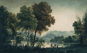
There are also some interesting historical sites near the lake, especially around the Charles-Talbot bay. The lake is also the starting point of the Linear park of the Saint-Charles and Berger rivers, a great place for walks and bike rides.
Quick Facts About the Lake
- Shape: Lake Saint-Charles looks a bit like the number "8" because it has two main parts, a north and a south pool.
- Lake Area: The lake covers about 3.6 square kilometers (1.4 square miles).
- Length: It is about 5.5 kilometers (3.4 miles) long from north to south.
- Depth: The deepest part of the lake is about 17.5 meters (57 feet) in its northern section.
- Volume: The lake holds about 15 million cubic meters of water.
- Watershed Area: The area of land that drains water into the lake is about 170 square kilometers (65.6 square miles).
Rivers and Streams Flowing In
Several rivers and streams flow into Lake Saint-Charles, bringing water from the surrounding land:
- Rivière des Hurons
- Water flowing from Lac Delage
- Talbot Creek
- Short-boot stream
 | Leon Lynch |
 | Milton P. Webster |
 | Ferdinand Smith |


