Lake Valley (Nevada) facts for kids
Quick facts for kids Lake Valley |
|
|---|---|
| Length | 60 mi (97 km) N-S |
| Geography | |
| Country | United States |
| State | Nevada |
| Region | Great Basin |
| County | White Pine |
| Population centers | Pioche and Pony Springs |
| Borders on |
List
|
| River | Patterson Wash-South Valley |
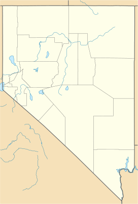
Lake Valley is a long valley, about 60 miles (97 km) from north to south. It is located in the northeast part of Lincoln County, Nevada. This valley is special because it has two main parts.
The northern part of Lake Valley is an endorheic basin. This means any water that flows into it stays there and does not flow out to a river or ocean. Instead, it usually sinks into the ground or evaporates.
The southern part of Lake Valley is different. It contains a stream called Patterson Wash. This stream flows into the Meadow Valley Wash, which eventually connects to larger water systems. A "water divide" is like a high point that separates two different drainage areas. In Lake Valley, a water divide splits the northern and southern parts. This divide is also part of the larger Great Basin Divide in southeast Nevada.
About 6 miles (10 km) of the northern part of Lake Valley extends into White Pine County.
Contents
Exploring Lake Valley's Features
Pony Springs and the Valley Divide
Pony Springs, Nevada is a small community located near the water divide. This divide separates the North and South Lake Valleys. At this point, the valley becomes narrower, only about 2.5 miles (4 km) wide. A hill called Squaw Knoll, which is 6,544 feet (1,995 m) tall, is on the east side of this divide.
The center of this water divide is about 7 miles (11 km) southeast of Pony Springs. U.S. Route 93 runs along the western edge of the valley. This highway leaves South Lake Valley near Pioche and continues south. It also travels north past North Lake Valley, connecting to U.S. Route 50 in Nevada about 25 miles (40 km) further.
North Lake Valley: A Closed Basin
The North Lake Valley is mostly flat. It is slightly narrower than the South Valley, reaching about 9 miles (14 km) at its widest point. This northern part of the valley runs straight north-south.
To its east, it is bordered by the Fortification Range. This is a short and narrow mountain range. The Fortification Range is located at the very southeast end of the much larger Spring Valley.
South Lake Valley: Flowing Waters
The South Lake Valley stretches for about 30 miles (48 km) until it reaches Hamlight Canyon and the Meadow Valley Wash. The part that trends southeast is about 20 miles (32 km) long.
Patterson Wash starts at the north-south water divide. It flows south and then southeast along the western side of the valley. This stream begins east of the Fairview Range. The Fairview Range is a small mountain range on the west side of the central water divide. Patterson Wash then flows southeast along the northeast side of the Bristol Range. It passes by Pioche and joins Meadow Valley Wash about 5 miles (8 km) further on.
 | William M. Jackson |
 | Juan E. Gilbert |
 | Neil deGrasse Tyson |


