Lampeter, Pennsylvania facts for kids
Quick facts for kids
Lampeter, Pennsylvania
|
|
|---|---|
 |
|
| Country | United States |
| State | Pennsylvania |
| County | Lancaster |
| Township | West Lampeter |
| Area | |
| • Total | 1.72 sq mi (4.45 km2) |
| • Land | 1.72 sq mi (4.44 km2) |
| • Water | 0.00 sq mi (0.00 km2) |
| Elevation | 407 ft (124 m) |
| Population
(2020)
|
|
| • Total | 1,737 |
| • Density | 1,012.83/sq mi (390.98/km2) |
| Time zone | UTC-5 (Eastern (EST)) |
| • Summer (DST) | UTC-4 (EDT) |
| ZIP code |
17537
|
| Area code(s) | 717 |
| FIPS code | 42-41192 |
| GNIS feature ID | 1203977 |
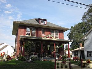
Lampeter is a small community in Lancaster County, Pennsylvania, United States. It's known as a census-designated place (CDP), which means it's a special area defined by the U.S. Census Bureau for gathering population data. In 2010, about 1,669 people lived here. Lampeter is a suburb of the city of Lancaster. The community got its name from a town called Lampeter in Wales.
Contents
Where is Lampeter Located?
Lampeter is in the middle of Lancaster County. It's in the eastern part of West Lampeter Township. To its west, you'll find the community of Willow Street.
Lampeter is about 5 miles (8 km) southeast of Lancaster, which is the county seat. Pennsylvania Route 741 goes right through the center of Lampeter. This road leads east about 3 miles (5 km) to Strasburg. U.S. Route 222 runs along the western edge of Lampeter. It separates Lampeter from Willow Street. Route 222 goes north into Lancaster and southeast to Quarryville.
Land and Water in Lampeter
The Lampeter area covers about 1.7 square miles (4.4 square kilometers). Most of this area is land. Only a tiny part, about 0.08%, is water.
Water from Lampeter flows north into Big Spring Run. This run then joins Mill Creek. Mill Creek is a smaller river that flows into the Conestoga River. Some streams in Lampeter also flow south into Pequea Creek. Both the Conestoga River and Pequea Creek eventually flow into the large Susquehanna River.
How Many People Live in Lampeter?
| Historical population | |||
|---|---|---|---|
| Census | Pop. | %± | |
| 2020 | 1,737 | — | |
| U.S. Decennial Census | |||
In 2020, the population of Lampeter was 1,737 people. This information comes from the U.S. Decennial Census, which counts everyone in the country every ten years.
Exploring Lampeter's Neighborhoods
Lampeter has several different neighborhoods, each with its own unique feel.
Lampeter Village
Lampeter Village is one of the smaller neighborhoods in Lampeter. It is part of the Lampeter-Strasburg School District. Its main road is Lampeter Road.
Pioneer Woods
Pioneer Woods is a neighborhood with apartments. It is located off Lampeter Road. This area is split into two sections. You can find 1, 2, and 3-bedroom apartments here, as well as townhouses.
Applecroft
Applecroft is a neighborhood located off Lampeter Road. It is known as a middle-class area in Lampeter.
Candlestick
Candlestick is another middle-class neighborhood in Lampeter. It is located off Village Road. A local cafe called "Busted Bean Cafe" opened at the entrance of this neighborhood in 2012.
Hunter's Ridge
Hunter's Ridge is an upper-middle-class neighborhood. It is located in a more rural area, further away from Lampeter Road.
Lampeter's Fire Department
The Lampeter Fire Department is very important to the community. One of its buildings is located in the nearby community of Willow Street.
The Lampeter Fire Station is run entirely by volunteers. These volunteers have been serving the community for over 96 years! Every September, the Lampeter Fire Company hosts the Lampeter Fair for three days. This fair is a big event where local people can show off their animals, farm produce, and artwork. It's also a fundraiser for the fire company and helps bring the community together.
See also
 In Spanish: Lampeter (Pensilvania) para niños
 | May Edward Chinn |
 | Rebecca Cole |
 | Alexa Canady |
 | Dorothy Lavinia Brown |


