Langness Peninsula facts for kids
Quick facts for kids Langness Peninsula |
|
|---|---|
 Langness Peninsula and St Michael's Isle |
|
| Crown dependency | Isle of Man |

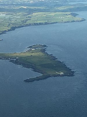
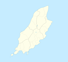
Langness is a long piece of land that sticks out into the sea. It's found at the very southern tip of the Isle of Man. Its name comes from an old language called Old Norse. It means "long promontory" or "long piece of land sticking out".
Langness was once a separate island. Over time, sand and stones built up along Castletown Bay. This joined Langness to the main island, forming a natural bridge called a tombolo. The small village of Derbyhaven is located on the eastern side of this narrow strip of land. It is also very close to the town of Castletown, Isle of Man.
Contents
History of Langness Peninsula
The old Manx name for Langness was Oaie Ny Baatyn Marroo. This means "Grave yard of the Lost Ships." Before the Langness Lighthouse was built in 1880, many ships crashed here.
The Old Foghorn
When it was foggy, the only way to warn ships was with a cow's horn. Men would blow this horn from the shore. However, the sound only traveled about half a mile. This was not enough to keep ships safe.
The Potato Grave Story
Near the lighthouse, there is a grassy mound known as the Potato Grave. In 1832, a ship was carrying workers from Ireland to the Isle of Man. These workers were coming to help dig potatoes. Sadly, the ship was lost, and all the people on board died.
Thirty-two bodies washed ashore on Langness. It was a tradition on the island to bury bodies found on the coast. So, a large grave was dug for all 32 people. There is no stone marker for the grave. The only reminder of the victims is the turf-covered mound.
Geography of Langness
Langness Peninsula is close to Ronaldsway Airport. If you are landing on Runway 26, you can get a great view of the peninsula from the plane. It's also easy to walk to Langness from Castletown. The peninsula has a fun nature trail to explore.
Coastal Features
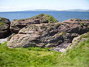
Coastal erosion has shaped parts of the coast into interesting sea arches. These are natural bridges made of rock. The rocks here are also special because they show an unconformity. This means some rocks are nearly 500 million years old. Other parts are much younger, about 150 million years younger.
The very southern tip of the peninsula is called Dreswick Point. This is the southernmost point of the main Isle of Man. St Michael's Isle (also known as Fort Island) is connected to the northern end of Langness. It is linked by a narrow causeway.
Important Structures
One important building on the peninsula is the Herring Tower. It was built in 1811. This tower is a daymark, which helps ships find their way during the day. You can also find the remains of a World War II gun training range near the lighthouse. There is also a memorial to Henry Madoc, a local nature expert and the island's police chief.
Wildlife and Nature
Langness Peninsula is a very popular spot for people who love watching birds. You can see many different types of birds here. These include golden plovers and curlews. You might also spot merlins and kestrels. St Michael's Isle is a special place for birds, as it is a bird sanctuary.
Sometimes, you can even see dolphins and porpoises swimming in the waters around the peninsula.
Leisure Activities
The Castletown Golf & Country Club is located on the peninsula. It is also on the narrow strip of land connecting Langness to Derbyhaven. This golf course has hosted many international championships. For example, in 2005, the Duke of York Young Champions Trophy golf championships were held there.
 | Precious Adams |
 | Lauren Anderson |
 | Janet Collins |


