Langworthy, Iowa facts for kids
Quick facts for kids
Langworthy, Iowa
|
|
|---|---|
| Country | United States |
| State | Iowa |
| County | Jones |
| Elevation | 860 ft (260 m) |
| Time zone | UTC-6 (Central (CST)) |
| • Summer (DST) | UTC-5 (CDT) |
| GNIS feature ID | 458223 |
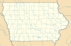
Langworthy is a small, unincorporated community located in the state of Iowa, in the United States. It's found in the north-central part of Jones County. You can find Langworthy along U.S. Route 151, just north of the city of Anamosa. Anamosa is the main town, or county seat, for Jones County. Langworthy sits at an elevation of about 860 feet (262 meters) above sea level.
Contents
A Look Back at Langworthy's History
How Langworthy Started
Langworthy was officially planned and laid out in 1858. This process is called "platting." A man named Colonel W. T. Shaw was responsible for creating the town's first map and dividing the land into lots.
The Post Office Story
For many years, Langworthy had its own post office. It first opened its doors on January 25, 1875. This was a very important place for people to send and receive letters and packages. However, the post office eventually closed down on January 18, 1974. After it closed, Langworthy's mail services were handled by the post office in nearby Monticello. Even though the post office is gone, Langworthy still has its own special ZIP Code, which is 52252.
How Many People Lived Here?
The number of people living in Langworthy has changed over time. In 1915, there were only 26 people living in the community. By 1940, the population had grown quite a bit, reaching 100 people.
 | William Lucy |
 | Charles Hayes |
 | Cleveland Robinson |


