Lansdowne, Virginia facts for kids
Quick facts for kids
Lansdowne, Virginia
|
|
|---|---|
| Country | |
| State | |
| County | |
| Area | |
| • Total | 4.12 sq mi (10.68 km2) |
| • Land | 4.04 sq mi (10.47 km2) |
| • Water | 0.08 sq mi (0.21 km2) |
| Elevation | 340 ft (100 m) |
| Population
(2010)
|
|
| • Total | 11,253 |
| • Density | 2,783/sq mi (1,074.6/km2) |
| Time zone | UTC−5 (Eastern (EST)) |
| • Summer (DST) | UTC−4 (EDT) |
| ZIP code |
20176
|
| FIPS code | 51-44048 |
| GNIS feature ID | 2584864 |
Lansdowne is a special place in Loudoun County, Virginia. It is called a census-designated place, which means it's an area that looks like a town but isn't officially a city or town. It is also a planned community, meaning it was designed and built in an organized way.
Lansdowne is located near Leesburg. In 2010, about 11,253 people lived there. You can find Lansdowne north of State Route 7 and south of the Potomac River. Long ago, before the American Revolutionary War, the Lee family started a large estate called Coton Manor here.
A part of the Potomac Heritage Trail runs through Lansdowne. This is a path for walking and enjoying nature. Lansdowne is also home to important places like Inova Loudoun Hospital, the Jack Kent Cooke Foundation, and Lansdowne Resort. It also has Lansdowne Woods of Virginia, which is a community for older adults. Lansdowne is part of the larger Washington metropolitan area.
Contents
Where is Lansdowne?
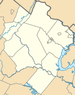
Lansdowne is in the eastern part of Loudoun County. It is about 32 miles (51 km) northwest of downtown Washington, D.C.. It is also about 5 miles (8 km) southeast of Leesburg, which is the main town of Loudoun County.
To the south, across Route 7, Lansdowne borders Belmont and Ashburn. To the northeast, across the Potomac River, it borders Montgomery County, Maryland.
The total area of Lansdowne is about 10.7 square kilometers (4.1 square miles). Most of this area is land, but about 0.2 square kilometers (0.1 square miles) is water. Goose Creek flows through the northwestern part of Lansdowne. It then joins the Potomac River at the northern edge of the community.
Living in Lansdowne: Homeowners' Associations
In Lansdowne, there are three main groups that manage the homes and neighborhoods. These are called homeowners' associations (HOAs).
- The largest group is the Lansdowne on the Potomac HOA. It looks after more than 2,200 homes. This area is next to the Potomac Station community.
- The second group is Lansdowne Woods of Virginia. This HOA includes five different condominium groups. Together, they manage 1,057 homes, mostly for older adults.
- The third group is Lansdowne Village Greens. This HOA looks after over 500 homes. These homes are around the Lansdowne Town Center area.
Schools in Lansdowne
Students living in Lansdowne go to schools run by Loudoun County Public Schools.
- Elementary School: Children in the western part of Lansdowne attend Seldens Landing Elementary School. Those in the eastern part go to Steuart W. Weller Elementary School in Ashburn.
- Middle School: Middle school students attend Belmont Ridge Middle School, which is in Lansdowne.
- High School: High school students go to Riverside High School, also located in Lansdowne.
In the past, students from Lansdowne attended other schools. These included Tuscarora High School (from 2010 to 2015) and Stone Bridge High School (from 2002 to 2010). Some also went to Eagle Ridge Middle School (from 2002 to 2003) and Belmont Station Elementary School (from 2008 to 2013).
See also
In Spanish: Lansdowne (Virginia) para niños
 | Laphonza Butler |
 | Daisy Bates |
 | Elizabeth Piper Ensley |


