Lapeer Township, Michigan facts for kids
Quick facts for kids
Lapeer Township, Michigan
|
|
|---|---|

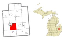
Location within Lapeer County
|
|
| Country | United States |
| State | Michigan |
| County | Lapeer |
| Area | |
| • Total | 32.3 sq mi (83.7 km2) |
| • Land | 32.0 sq mi (82.9 km2) |
| • Water | 0.3 sq mi (0.8 km2) |
| Elevation | 860 ft (262 m) |
| Population
(2020)
|
|
| • Total | 4,956 |
| • Density | 153.44/sq mi (59.21/km2) |
| Time zone | UTC-5 (Eastern (EST)) |
| • Summer (DST) | UTC-4 (EDT) |
| ZIP code | |
| Area code(s) | 810 |
| FIPS code | 26-46060 |
| GNIS feature ID | 1626591 |
Lapeer Township is a special area in Lapeer County, located in the state of Michigan. It's known as a "civil township," which is a type of local government area. In 2020, about 4,956 people called Lapeer Township home. The name "Lapeer" comes from a French phrase, La pierre, which means "flint" or "flint stone."
Contents
Exploring Lapeer Township's Communities
Lapeer Township is surrounded by and connected to several interesting communities.
- The city of Lapeer is located to the northwest. Even though it's very close, the city of Lapeer runs its own government. Most people living in Lapeer Township get their mail from the Lapeer post office, using the ZIP code 48446.
- Hunters Creek is a small, unincorporated community in the southern part of the township. An "unincorporated community" means it's a recognized place but doesn't have its own local government like a city or village. This settlement got its name from a nearby stream and has been around since about 1836. A post office opened here in 1857. Later, in 1872, it became a stop on the Detroit and Bay City Railroad.
- The community of Attica is to the east of Lapeer Township. The Attica Post Office, with ZIP code 48412, also delivers mail to some parts of eastern Lapeer Township.
- The village of Metamora is located to the south. Just like Attica, the Metamora post office, with ZIP code 48455, serves parts of southern Lapeer Township.
Geography of Lapeer Township
Lapeer Township covers a total area of about 32.3 square miles (83.7 square kilometers). Most of this area, about 32.0 square miles (82.9 square kilometers), is land. The rest, about 0.3 square miles (0.8 square kilometers), is water. This means that nearly all of Lapeer Township is land.
Who Lives in Lapeer Township?
Based on information from the year 2000, about 5,078 people lived in Lapeer Township. There were 1,765 households, which are like groups of people living together in one home. Most of these households, 72.8%, were married couples living together. About 37.3% of the households had children under 18 years old living with them.
The people living in Lapeer Township were spread across different age groups. About 27.1% were under 18 years old, and 9.6% were 65 years old or older. The average age in the township was 38 years.
The average income for a household in the township was about $63,411 per year. For families, the average income was around $66,136.
See also
 In Spanish: Municipio de Lapeer para niños


