Las Coloradas, Argentina facts for kids
Quick facts for kids
Las Coloradas
|
|
|---|---|

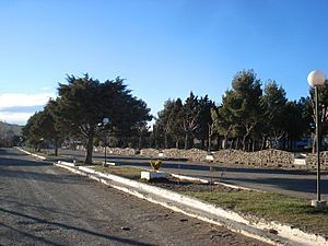
Central Square
|
|
| Country | |
| Province | Neuquén Province |
| Department | Catán Lil Department |
| Founded | October 26, 1926 |
| Elevation | 974 m (3,196 ft) |
| Population
(2001 census [INDEC])
|
|
| • Total | 833 |
| Time zone | UTC−3 (ART) |
| CPA Base |
Q 8341
|
| Area code(s) | +54 0242 |
| Climate | Csb |
| Website | Las Coloradas Municipality |
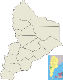
Las Coloradas is a small town in the Neuquén Province of Argentina. It's located in the southeast part of the province, in an area called the Catán Lil Department. It's the only town of its kind in this department, which means it's the main place for local government.
The town is connected to the rest of the province by Provincial Road 24. Because it's far from bigger cities, it feels a bit isolated. The main way people make a living here is through livestock farming, which means raising animals like cattle. There are also some shops and businesses in the town.
Kids in Las Coloradas can go to school all the way up to high school. There are also places that teach job skills for people who want to work in the province. The town's hospital, Doctor Carlos Potente Hospital, takes care of everyone's health needs. Many Mapuche people live in Las Coloradas and in the areas around it.
Contents
History of Las Coloradas
Las Coloradas started as a small settlement in the early 1900s. It was part of a large farm that raised animals. Back then, it already had a court and a police station. The town was officially founded on October 26, 1926. On that day, it was also named the main town for the Catán Lil Department.
There are a few stories about how Las Coloradas got its name, which means "The Red Ones." One story says it was named after the red color of a type of cattle called Hereford cattle. These cows were brought to the area when the big farm first opened.
Geography and Location
Las Coloradas is the only town in the Catan Lil Department. This department is in the southeast part of the Neuquén Province. The town is located right on Provincial Road 24. This road connects to National Route 40, which is a major highway. Route 40 can take you north to Zapala or south to Junín de los Andes.
However, Provincial Road 24 isn't always in great condition. This, along with the town's distance from bigger cities, makes the area feel quite remote. The town is surrounded by mountains, and the Catán Lil River flows right next to it. A cool natural spot nearby is called Garganta del Diablo, which means "The Devil's Throat." It's a canyon over 150 meters long where the Catán Lil River flows through. It's a popular place for visitors.
Population and Communities
In 2016, about 1,776 people lived in Las Coloradas. Before that, official counts showed fewer people. For example, in 1980, there were 294 residents. In 1991, there were 651, and in 2001, the number grew to 833.
Mapuche Communities
Many Mapuche communities live in the countryside around the Catan Lil Department. Some of these communities are called Namuncurá, Ram, and Cayulef. They are connected to Las Coloradas by country roads. A group called the Hue Che Foundation works in the town. They help native communities in the central part of Neuquén province, especially with education and social support.
Economy and Work
The main part of the local economy is livestock farming. This means raising animals like cows, sheep, or goats for their meat, milk, or wool. There are also some shops and businesses in Las Coloradas. For many years, there haven't been many big companies in the area. Also, the amount of goods produced has been very low. This has sometimes led to high unemployment and lower wages for people living there.


