Latexo, Texas facts for kids
Quick facts for kids
Latexo, Texas
|
|
|---|---|

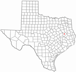
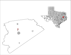
Location of Latexo, Texas
|
|
 |
|
| Country | United States |
| State | Texas |
| County | Houston |
| Area | |
| • Total | 0.98 sq mi (2.54 km2) |
| • Land | 0.98 sq mi (2.54 km2) |
| • Water | 0.00 sq mi (0.00 km2) |
| Elevation | 371 ft (113 m) |
| Population
(2020)
|
|
| • Total | 232 |
| • Density | 236.7/sq mi (91.3/km2) |
| Time zone | UTC-6 (Central (CST)) |
| • Summer (DST) | UTC-5 (CDT) |
| ZIP code |
75849
|
| Area code(s) | 936 |
| FIPS code | 48-41644 |
| GNIS feature ID | 2411632 |
Latexo (pronounced luh-TEK-soh) is a small city in Houston County, Texas, United States. In 2020, about 232 people lived there.
History of Latexo
Latexo got its start just after the year 1900. A company called the Louisiana Texas Orchard Company bought a large piece of land, about 3,000 acres (12 square kilometers). They planned a town on this land and named it "Latexo." This name is a short version of their company's name.
Over the years, five different school buildings have been built in the Latexo community. The first school, called Bethel, was near the railroad tracks. Later, another Bethel school was built nearby. This second building was eventually sold and used as a church. The school moved a third time to its current spot in 1930. Since then, two new buildings have replaced the older ones on the same school property.
Geography of Latexo
Latexo is located in the northern part of Houston County, Texas. The main road that goes through the city is U.S. Route 287. If you travel south on this road for about 5 miles (8 km), you will reach Crockett, which is the main city and government center of the county. If you go north for about 7 miles (11 km), you will find Grapeland.
The United States Census Bureau says that Latexo covers a total area of about 1 square mile (2.5 square kilometers). All of this area is land, meaning there are no large bodies of water like lakes or rivers within the city limits.
Population and People
| Historical population | |||
|---|---|---|---|
| Census | Pop. | %± | |
| 1980 | 312 | — | |
| 1990 | 289 | −7.4% | |
| 2000 | 272 | −5.9% | |
| 2010 | 322 | 18.4% | |
| 2020 | 232 | −28.0% | |
| U.S. Decennial Census 2020 Census |
|||
In the year 2000, there were 272 people living in Latexo. These people lived in 116 households, and 70 of these were families. The city had about 276 people per square mile.
Many different people make up Latexo. In 2000, most residents were White, with smaller groups of African American, Native American, and Asian people. Some residents were also from other backgrounds or identified with two or more races. About 5.5% of the population was Hispanic or Latino.
About 29% of the households in Latexo had children under 18 years old living with them. Many households were married couples, while others were single-parent families or individuals living alone. The average household had about 2.3 people, and families averaged about 3 people.
The ages of people in Latexo varied. About 26.5% of the population was under 18 years old. About 15% of the people were 65 years or older. The average age in the city was 39 years old.
Education in Latexo
Students in Latexo attend schools that are part of the Latexo Independent School District.
See also
 In Spanish: Latexo para niños
 | Toni Morrison |
 | Barack Obama |
 | Martin Luther King Jr. |
 | Ralph Bunche |

